You are here: Home > Network List > TA - USArray Transportable Network (new EarthScope stations) Stations List
> Station Q42A Golden Eagle, IL, USA > Earthquake Result Viewer
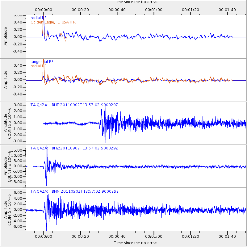
Q42A Golden Eagle, IL, USA - Earthquake Result Viewer

| Earthquake location: |
Santiago Del Estero Prov., Arg. |
| Earthquake latitude/longitude: |
-28.4/-63.0 |
| Earthquake time(UTC): |
2011/09/02 (245) 13:47:09 GMT |
| Earthquake Depth: |
579 km |
| Earthquake Magnitude: |
6.4 MB, 6.7 MW, 6.7 MW |
| Earthquake Catalog/Contributor: |
WHDF/NEIC |
|
| Network: |
TA USArray Transportable Network (new EarthScope stations) |
| Station: |
Q42A Golden Eagle, IL, USA |
| Lat/Lon: |
38.91 N/90.53 W |
| Elevation: |
175 m |
|
| Distance: |
71.7 deg |
| Az: |
337.701 deg |
| Baz: |
154.629 deg |
| Ray Param: |
0.052182984 |
| Estimated Moho Depth: |
38.5 km |
| Estimated Crust Vp/Vs: |
2.10 |
| Assumed Crust Vp: |
6.498 km/s |
| Estimated Crust Vs: |
3.101 km/s |
| Estimated Crust Poisson's Ratio: |
0.35 |
|
| Radial Match: |
88.00067 % |
| Radial Bump: |
400 |
| Transverse Match: |
74.81804 % |
| Transverse Bump: |
400 |
| SOD ConfigId: |
414626 |
| Insert Time: |
2012-01-18 09:21:08.643 +0000 |
| GWidth: |
2.5 |
| Max Bumps: |
400 |
| Tol: |
0.001 |
|
Signal To Noise
| Channel | StoN | STA | LTA |
| TA:Q42A: :BHZ:20110902T13:57:02.900029Z | 23.88386 | 5.705519E-6 | 2.3888597E-7 |
| TA:Q42A: :BHN:20110902T13:57:02.900029Z | 16.597046 | 2.6007374E-6 | 1.5669882E-7 |
| TA:Q42A: :BHE:20110902T13:57:02.900029Z | 10.7872925 | 1.1199253E-6 | 1.0381895E-7 |
| Arrivals |
| Ps | 6.7 SECOND |
| PpPs | 18 SECOND |
| PsPs/PpSs | 24 SECOND |


