You are here: Home > Network List > TA - USArray Transportable Network (new EarthScope stations) Stations List
> Station R41A Rosebud, MO, USA > Earthquake Result Viewer
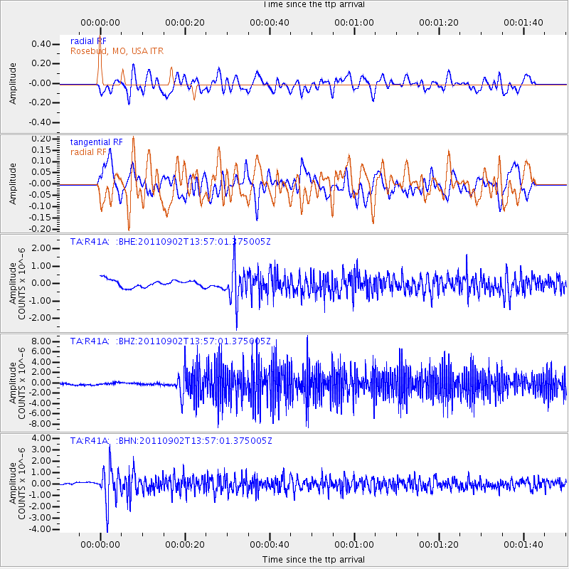
R41A Rosebud, MO, USA - Earthquake Result Viewer
*The percent match for this event was below the threshold and hence no stack was calculated.
| Earthquake location: |
Santiago Del Estero Prov., Arg. |
| Earthquake latitude/longitude: |
-28.4/-63.0 |
| Earthquake time(UTC): |
2011/09/02 (245) 13:47:09 GMT |
| Earthquake Depth: |
579 km |
| Earthquake Magnitude: |
6.4 MB, 6.7 MW, 6.7 MW |
| Earthquake Catalog/Contributor: |
WHDF/NEIC |
|
| Network: |
TA USArray Transportable Network (new EarthScope stations) |
| Station: |
R41A Rosebud, MO, USA |
| Lat/Lon: |
38.30 N/91.38 W |
| Elevation: |
257 m |
|
| Distance: |
71.5 deg |
| Az: |
336.79 deg |
| Baz: |
153.815 deg |
| Ray Param: |
$rayparam |
*The percent match for this event was below the threshold and hence was not used in the summary stack. |
|
| Radial Match: |
30.91146 % |
| Radial Bump: |
400 |
| Transverse Match: |
51.5892 % |
| Transverse Bump: |
400 |
| SOD ConfigId: |
414626 |
| Insert Time: |
2012-01-18 09:24:57.787 +0000 |
| GWidth: |
2.5 |
| Max Bumps: |
400 |
| Tol: |
0.001 |
|
Signal To Noise
| Channel | StoN | STA | LTA |
| TA:R41A: :BHZ:20110902T13:57:01.375005Z | 1.1064078 | 1.8380031E-7 | 1.6612348E-7 |
| TA:R41A: :BHN:20110902T13:57:01.375005Z | 11.381466 | 1.5370389E-6 | 1.3504753E-7 |
| TA:R41A: :BHE:20110902T13:57:01.375005Z | 4.913277 | 1.0083013E-6 | 2.0521972E-7 |
| Arrivals |
| Ps | |
| PpPs | |
| PsPs/PpSs | |


