You are here: Home > Network List > TA - USArray Transportable Network (new EarthScope stations) Stations List
> Station P56A Dayton Farm, Ripley, WV, USA > Earthquake Result Viewer
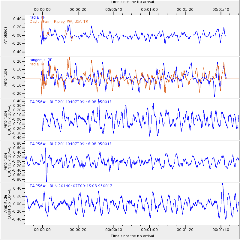
P56A Dayton Farm, Ripley, WV, USA - Earthquake Result Viewer
*The percent match for this event was below the threshold and hence no stack was calculated.
| Earthquake location: |
Kuril Islands |
| Earthquake latitude/longitude: |
50.4/156.3 |
| Earthquake time(UTC): |
2014/04/07 (097) 09:34:49 GMT |
| Earthquake Depth: |
85 km |
| Earthquake Magnitude: |
5.2 MW |
| Earthquake Catalog/Contributor: |
ISC/ISC |
|
| Network: |
TA USArray Transportable Network (new EarthScope stations) |
| Station: |
P56A Dayton Farm, Ripley, WV, USA |
| Lat/Lon: |
39.50 N/78.84 W |
| Elevation: |
249 m |
|
| Distance: |
78.2 deg |
| Az: |
40.456 deg |
| Baz: |
327.557 deg |
| Ray Param: |
$rayparam |
*The percent match for this event was below the threshold and hence was not used in the summary stack. |
|
| Radial Match: |
45.662945 % |
| Radial Bump: |
400 |
| Transverse Match: |
55.153202 % |
| Transverse Bump: |
400 |
| SOD ConfigId: |
3390531 |
| Insert Time: |
2019-04-11 05:03:16.650 +0000 |
| GWidth: |
2.5 |
| Max Bumps: |
400 |
| Tol: |
0.001 |
|
Signal To Noise
| Channel | StoN | STA | LTA |
| TA:P56A: :BHZ:20140407T09:46:08.95001Z | 2.2149334 | 3.2482112E-7 | 1.4665052E-7 |
| TA:P56A: :BHN:20140407T09:46:08.95001Z | 1.4693004 | 1.8514359E-7 | 1.2600799E-7 |
| TA:P56A: :BHE:20140407T09:46:08.95001Z | 1.9680109 | 2.0241963E-7 | 1.0285494E-7 |
| Arrivals |
| Ps | |
| PpPs | |
| PsPs/PpSs | |


