You are here: Home > Network List > US - United States National Seismic Network Stations List
> Station DGMT Dagmar, Montana, USA > Earthquake Result Viewer
DGMT Dagmar, Montana, USA - Earthquake Result Viewer
*The percent match for this event was below the threshold and hence no stack was calculated.
| Earthquake location: |
Kuril Islands |
| Earthquake latitude/longitude: |
50.4/156.3 |
| Earthquake time(UTC): |
2014/04/07 (097) 09:34:49 GMT |
| Earthquake Depth: |
85 km |
| Earthquake Magnitude: |
5.2 MW |
| Earthquake Catalog/Contributor: |
ISC/ISC |
|
| Network: |
US United States National Seismic Network |
| Station: |
DGMT Dagmar, Montana, USA |
| Lat/Lon: |
48.47 N/104.20 W |
| Elevation: |
0.0 m |
|
| Distance: |
59.8 deg |
| Az: |
49.457 deg |
| Baz: |
313.082 deg |
| Ray Param: |
$rayparam |
*The percent match for this event was below the threshold and hence was not used in the summary stack. |
|
| Radial Match: |
46.646664 % |
| Radial Bump: |
400 |
| Transverse Match: |
50.07179 % |
| Transverse Bump: |
400 |
| SOD ConfigId: |
3390531 |
| Insert Time: |
2019-04-11 05:04:11.802 +0000 |
| GWidth: |
2.5 |
| Max Bumps: |
400 |
| Tol: |
0.001 |
|
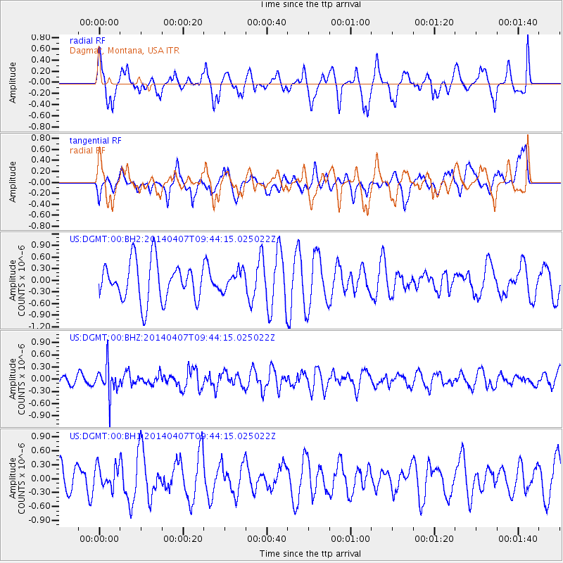
Signal To Noise
| Channel | StoN | STA | LTA |
| US:DGMT:00:BHZ:20140407T09:44:15.025022Z | 2.8438282 | 3.6380743E-7 | 1.2792876E-7 |
| US:DGMT:00:BH1:20140407T09:44:15.025022Z | 0.66456455 | 2.5580127E-7 | 3.849156E-7 |
| US:DGMT:00:BH2:20140407T09:44:15.025022Z | 0.5023998 | 2.523718E-7 | 5.0233257E-7 |
| Arrivals |
| Ps | |
| PpPs | |
| PsPs/PpSs | |


