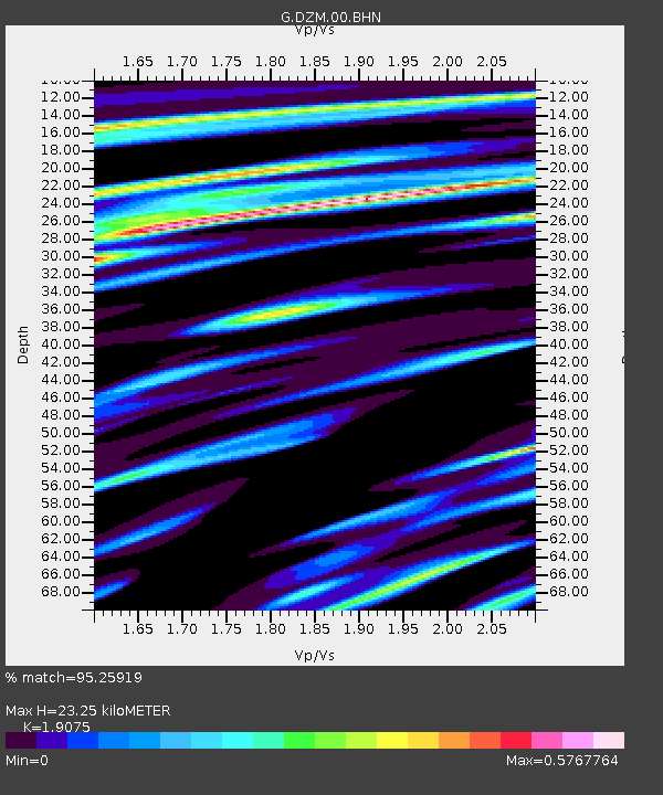
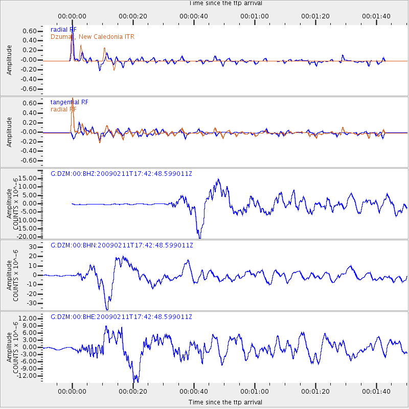
DZM Dzumac, New Caledonia - Earthquake Result Viewer

Earthquake location: Talaud Islands, Indonesia
Earthquake latitude/longitude: 3.9/126.4
Earthquake time(UTC): 2009/02/11 (042) 17:34:50 GMT
Earthquake Depth: 22 km
Earthquake Magnitude: 6.6 MB, 7.2 MS, 7.2 MW, 7.1 MW
Earthquake Catalog/Contributor: WHDF/NEIC
Network: G GEOSCOPE
Station: DZM Dzumac, New Caledonia
Lat/Lon: 22.07 S/166.44 E
Elevation: 878 m
Distance: 46.9 deg
Az: 125.169 deg
Baz: 298.446 deg
Ray Param: 0.070318595
Estimated Moho Depth: 23.25 km
Estimated Crust Vp/Vs: 1.91
Assumed Crust Vp: 5.14 km/s
Estimated Crust Vs: 2.695 km/s
Estimated Crust Poisson's Ratio: 0.31
Radial Match: 95.25919 %
Radial Bump: 343
Transverse Match: 89.27142 %
Transverse Bump: 400
SOD ConfigId: 2658
Insert Time: 2010-02-26 22:18:17.740 +0000
GWidth: 2.5
Max Bumps: 400
Tol: 0.001

Signal To Noise

ChannelStoNSTALTA
G:DZM:00:BHN:20090211T17:42:48.599011Z3.07243351.7534786E-65.7071327E-7
G:DZM:00:BHE:20090211T17:42:48.599011Z1.57022317.540584E-74.802238E-7
G:DZM:00:BHZ:20090211T17:42:48.599011Z4.0527587.2002416E-71.7766276E-7
Arrivals
Ps4.3 SECOND
PpPs13 SECOND
PsPs/PpSs17 SECOND