You are here: Home > Network List > US - United States National Seismic Network Stations List
> Station HAWA Hanford, Washington, USA > Earthquake Result Viewer
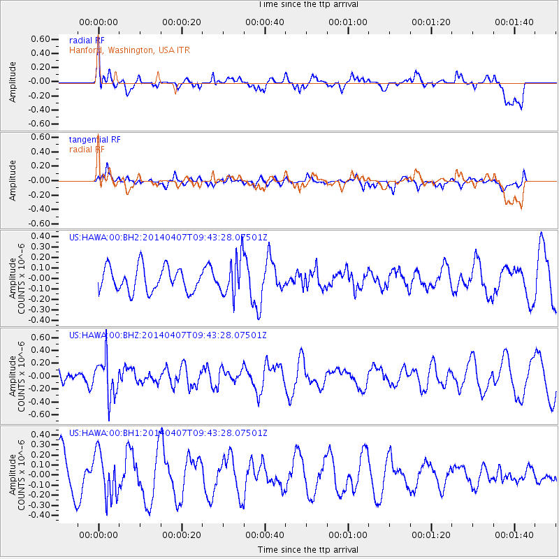
HAWA Hanford, Washington, USA - Earthquake Result Viewer
*The percent match for this event was below the threshold and hence no stack was calculated.
| Earthquake location: |
Kuril Islands |
| Earthquake latitude/longitude: |
50.4/156.3 |
| Earthquake time(UTC): |
2014/04/07 (097) 09:34:49 GMT |
| Earthquake Depth: |
85 km |
| Earthquake Magnitude: |
5.2 MW |
| Earthquake Catalog/Contributor: |
ISC/ISC |
|
| Network: |
US United States National Seismic Network |
| Station: |
HAWA Hanford, Washington, USA |
| Lat/Lon: |
46.39 N/119.53 W |
| Elevation: |
364 m |
|
| Distance: |
53.1 deg |
| Az: |
59.399 deg |
| Baz: |
307.303 deg |
| Ray Param: |
$rayparam |
*The percent match for this event was below the threshold and hence was not used in the summary stack. |
|
| Radial Match: |
61.31905 % |
| Radial Bump: |
400 |
| Transverse Match: |
42.975315 % |
| Transverse Bump: |
400 |
| SOD ConfigId: |
3390531 |
| Insert Time: |
2019-04-11 05:04:15.935 +0000 |
| GWidth: |
2.5 |
| Max Bumps: |
400 |
| Tol: |
0.001 |
|
Signal To Noise
| Channel | StoN | STA | LTA |
| US:HAWA:00:BHZ:20140407T09:43:28.07501Z | 2.6784346 | 2.9882986E-7 | 1.1156884E-7 |
| US:HAWA:00:BH1:20140407T09:43:28.07501Z | 1.482952 | 2.244887E-7 | 1.5137961E-7 |
| US:HAWA:00:BH2:20140407T09:43:28.07501Z | 1.6267729 | 1.880047E-7 | 1.15569115E-7 |
| Arrivals |
| Ps | |
| PpPs | |
| PsPs/PpSs | |


