You are here: Home > Network List > US - United States National Seismic Network Stations List
> Station MNTX Cornudas Mountains, Texas, USA > Earthquake Result Viewer
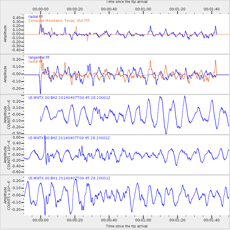
MNTX Cornudas Mountains, Texas, USA - Earthquake Result Viewer
*The percent match for this event was below the threshold and hence no stack was calculated.
| Earthquake location: |
Kuril Islands |
| Earthquake latitude/longitude: |
50.4/156.3 |
| Earthquake time(UTC): |
2014/04/07 (097) 09:34:49 GMT |
| Earthquake Depth: |
85 km |
| Earthquake Magnitude: |
5.2 MW |
| Earthquake Catalog/Contributor: |
ISC/ISC |
|
| Network: |
US United States National Seismic Network |
| Station: |
MNTX Cornudas Mountains, Texas, USA |
| Lat/Lon: |
31.70 N/105.38 W |
| Elevation: |
404 m |
|
| Distance: |
71.1 deg |
| Az: |
63.056 deg |
| Baz: |
318.015 deg |
| Ray Param: |
$rayparam |
*The percent match for this event was below the threshold and hence was not used in the summary stack. |
|
| Radial Match: |
42.37712 % |
| Radial Bump: |
363 |
| Transverse Match: |
52.964314 % |
| Transverse Bump: |
400 |
| SOD ConfigId: |
3390531 |
| Insert Time: |
2019-04-11 05:04:20.186 +0000 |
| GWidth: |
2.5 |
| Max Bumps: |
400 |
| Tol: |
0.001 |
|
Signal To Noise
| Channel | StoN | STA | LTA |
| US:MNTX:00:BHZ:20140407T09:45:28.20001Z | 2.4139836 | 2.2779243E-7 | 9.43637E-8 |
| US:MNTX:00:BH1:20140407T09:45:28.20001Z | 1.3250947 | 1.2861489E-7 | 9.7060905E-8 |
| US:MNTX:00:BH2:20140407T09:45:28.20001Z | 1.0100749 | 8.8993076E-8 | 8.810543E-8 |
| Arrivals |
| Ps | |
| PpPs | |
| PsPs/PpSs | |


