You are here: Home > Network List > US - United States National Seismic Network Stations List
> Station MSO Missoula, Montana, USA > Earthquake Result Viewer
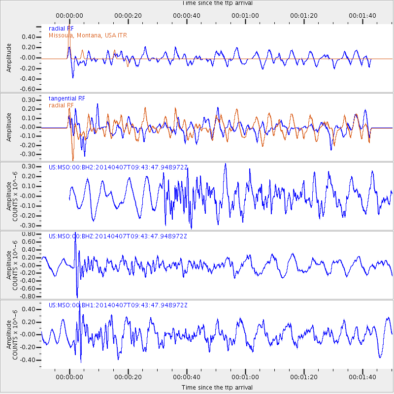
MSO Missoula, Montana, USA - Earthquake Result Viewer
*The percent match for this event was below the threshold and hence no stack was calculated.
| Earthquake location: |
Kuril Islands |
| Earthquake latitude/longitude: |
50.4/156.3 |
| Earthquake time(UTC): |
2014/04/07 (097) 09:34:49 GMT |
| Earthquake Depth: |
85 km |
| Earthquake Magnitude: |
5.2 MW |
| Earthquake Catalog/Contributor: |
ISC/ISC |
|
| Network: |
US United States National Seismic Network |
| Station: |
MSO Missoula, Montana, USA |
| Lat/Lon: |
46.83 N/113.94 W |
| Elevation: |
1264 m |
|
| Distance: |
55.9 deg |
| Az: |
56.041 deg |
| Baz: |
309.405 deg |
| Ray Param: |
$rayparam |
*The percent match for this event was below the threshold and hence was not used in the summary stack. |
|
| Radial Match: |
52.896732 % |
| Radial Bump: |
400 |
| Transverse Match: |
67.985695 % |
| Transverse Bump: |
400 |
| SOD ConfigId: |
3390531 |
| Insert Time: |
2019-04-11 05:04:21.010 +0000 |
| GWidth: |
2.5 |
| Max Bumps: |
400 |
| Tol: |
0.001 |
|
Signal To Noise
| Channel | StoN | STA | LTA |
| US:MSO:00:BHZ:20140407T09:43:47.948972Z | 1.7592723 | 3.18955E-7 | 1.8129937E-7 |
| US:MSO:00:BH1:20140407T09:43:47.948972Z | 1.8604141 | 2.069494E-7 | 1.1123835E-7 |
| US:MSO:00:BH2:20140407T09:43:47.948972Z | 1.1674981 | 1.2957051E-7 | 1.1098134E-7 |
| Arrivals |
| Ps | |
| PpPs | |
| PsPs/PpSs | |


