
DZM Dzumac, New Caledonia - Earthquake Result Viewer
| ||||||||||||||||||
| ||||||||||||||||||
| ||||||||||||||||||
|
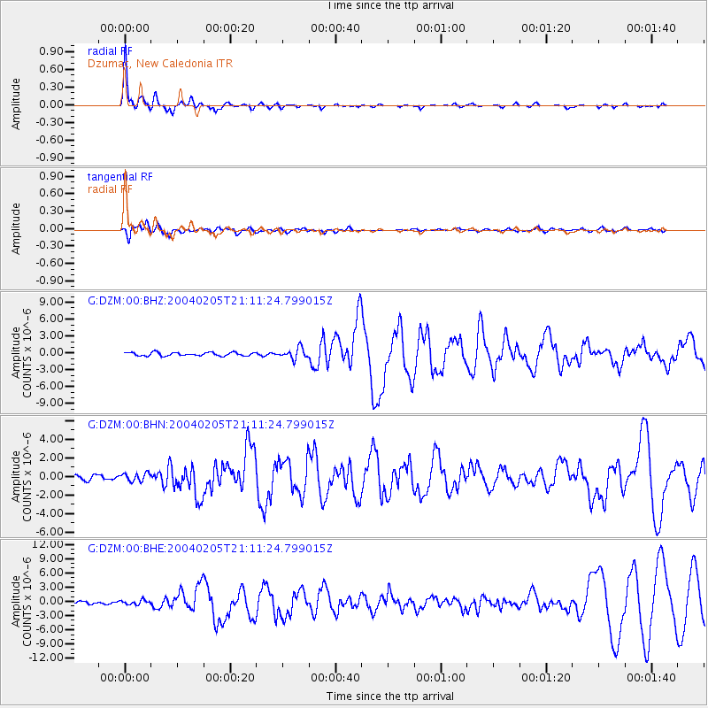
Signal To Noise
| Channel | StoN | STA | LTA |
| G:DZM:00:BHN:20040205T21:11:24.799015Z | 2.0084946 | 4.349276E-7 | 2.1654407E-7 |
| G:DZM:00:BHE:20040205T21:11:24.799015Z | 1.777954 | 5.0573607E-7 | 2.8444833E-7 |
| G:DZM:00:BHZ:20040205T21:11:24.799015Z | 3.1630294 | 9.56925E-7 | 3.0253432E-7 |
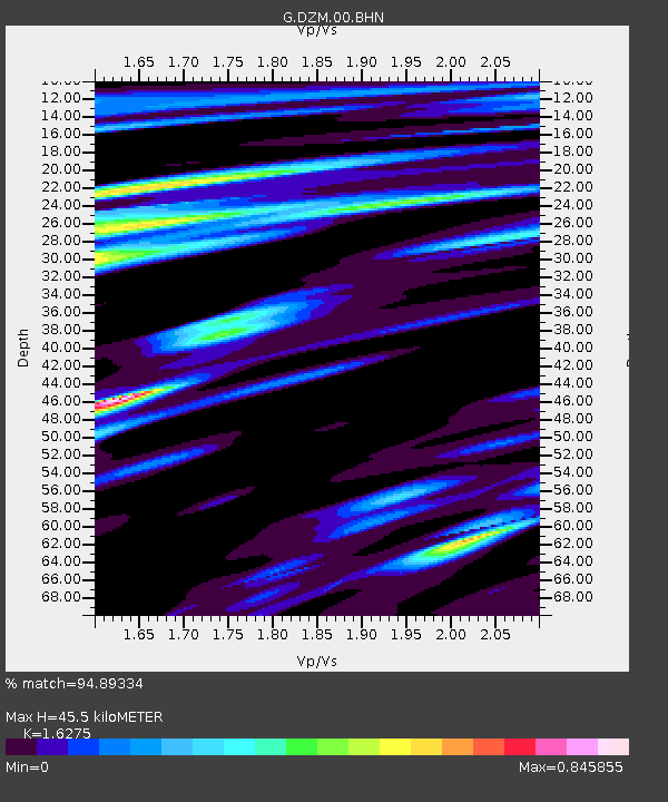
| Arrivals | |
| Ps | 5.8 SECOND |
| PpPs | 22 SECOND |
| PsPs/PpSs | 28 SECOND |

