You are here: Home > Network List > IW - Intermountain West Stations List
> Station MOOW Moose Ponds, Wyoming, USA > Earthquake Result Viewer
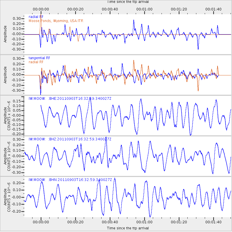
MOOW Moose Ponds, Wyoming, USA - Earthquake Result Viewer
*The percent match for this event was below the threshold and hence no stack was calculated.
| Earthquake location: |
Off Coast Of Central Chile |
| Earthquake latitude/longitude: |
-38.4/-74.9 |
| Earthquake time(UTC): |
2011/09/03 (246) 16:20:41 GMT |
| Earthquake Depth: |
12 km |
| Earthquake Magnitude: |
5.5 MB, 5.5 MS, 5.8 MW, 5.7 MW |
| Earthquake Catalog/Contributor: |
WHDF/NEIC |
|
| Network: |
IW Intermountain West |
| Station: |
MOOW Moose Ponds, Wyoming, USA |
| Lat/Lon: |
43.75 N/110.74 W |
| Elevation: |
2128 m |
|
| Distance: |
88.0 deg |
| Az: |
334.877 deg |
| Baz: |
152.607 deg |
| Ray Param: |
$rayparam |
*The percent match for this event was below the threshold and hence was not used in the summary stack. |
|
| Radial Match: |
42.710403 % |
| Radial Bump: |
400 |
| Transverse Match: |
49.139843 % |
| Transverse Bump: |
385 |
| SOD ConfigId: |
414626 |
| Insert Time: |
2012-01-20 09:08:31.680 +0000 |
| GWidth: |
2.5 |
| Max Bumps: |
400 |
| Tol: |
0.001 |
|
Signal To Noise
| Channel | StoN | STA | LTA |
| IW:MOOW: :BHZ:20110903T16:32:59.340027Z | 0.7446363 | 7.834076E-8 | 1.05206745E-7 |
| IW:MOOW: :BHN:20110903T16:32:59.340027Z | 2.9637694 | 1.3963475E-7 | 4.7113904E-8 |
| IW:MOOW: :BHE:20110903T16:32:59.340027Z | 1.161309 | 7.942968E-8 | 6.839668E-8 |
| Arrivals |
| Ps | |
| PpPs | |
| PsPs/PpSs | |


