You are here: Home > Network List > TA - USArray Transportable Network (new EarthScope stations) Stations List
> Station L04D Klamath Falls, OR, USA > Earthquake Result Viewer
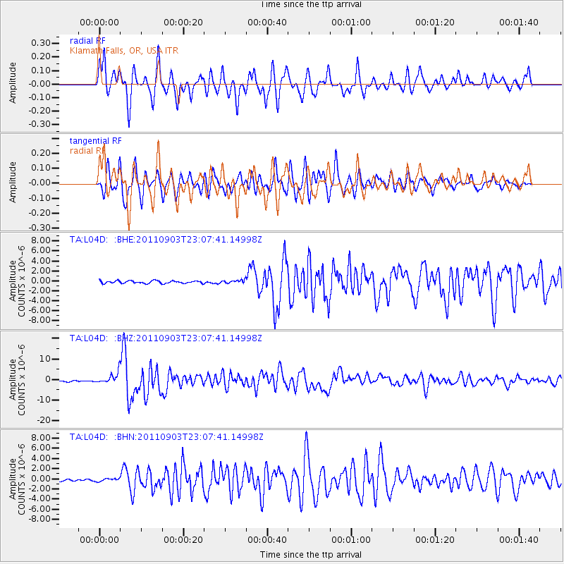
L04D Klamath Falls, OR, USA - Earthquake Result Viewer
*The percent match for this event was below the threshold and hence no stack was calculated.
| Earthquake location: |
Vanuatu Islands |
| Earthquake latitude/longitude: |
-20.7/169.7 |
| Earthquake time(UTC): |
2011/09/03 (246) 22:55:40 GMT |
| Earthquake Depth: |
185 km |
| Earthquake Magnitude: |
6.4 MB, 7.0 MW, 7.0 MW |
| Earthquake Catalog/Contributor: |
WHDF/NEIC |
|
| Network: |
TA USArray Transportable Network (new EarthScope stations) |
| Station: |
L04D Klamath Falls, OR, USA |
| Lat/Lon: |
42.22 N/122.30 W |
| Elevation: |
1437 m |
|
| Distance: |
88.5 deg |
| Az: |
43.541 deg |
| Baz: |
240.271 deg |
| Ray Param: |
$rayparam |
*The percent match for this event was below the threshold and hence was not used in the summary stack. |
|
| Radial Match: |
87.481674 % |
| Radial Bump: |
400 |
| Transverse Match: |
83.57387 % |
| Transverse Bump: |
400 |
| SOD ConfigId: |
414626 |
| Insert Time: |
2012-01-20 09:55:30.334 +0000 |
| GWidth: |
2.5 |
| Max Bumps: |
400 |
| Tol: |
0.001 |
|
Signal To Noise
| Channel | StoN | STA | LTA |
| TA:L04D: :BHZ:20110903T23:07:41.14998Z | 11.673343 | 2.7431838E-6 | 2.3499558E-7 |
| TA:L04D: :BHN:20110903T23:07:41.14998Z | 1.2104456 | 2.7837012E-7 | 2.2997327E-7 |
| TA:L04D: :BHE:20110903T23:07:41.14998Z | 1.2734822 | 3.2001466E-7 | 2.5129103E-7 |
| Arrivals |
| Ps | |
| PpPs | |
| PsPs/PpSs | |


