You are here: Home > Network List > TA - USArray Transportable Network (new EarthScope stations) Stations List
> Station A04D Lummi Island, WA, USA > Earthquake Result Viewer
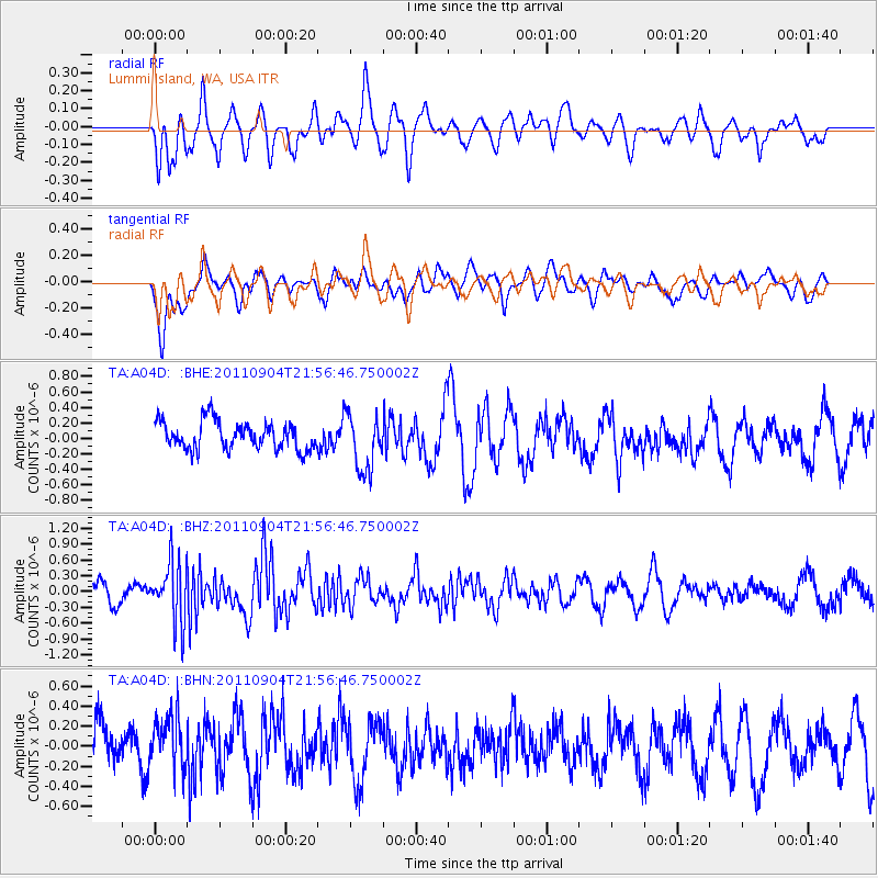
A04D Lummi Island, WA, USA - Earthquake Result Viewer
*The percent match for this event was below the threshold and hence no stack was calculated.
| Earthquake location: |
Vanuatu Islands |
| Earthquake latitude/longitude: |
-19.2/168.7 |
| Earthquake time(UTC): |
2011/09/04 (247) 21:44:18 GMT |
| Earthquake Depth: |
37 km |
| Earthquake Magnitude: |
5.7 MB, 5.4 MS, 5.9 MW, 5.9 MW |
| Earthquake Catalog/Contributor: |
WHDF/NEIC |
|
| Network: |
TA USArray Transportable Network (new EarthScope stations) |
| Station: |
A04D Lummi Island, WA, USA |
| Lat/Lon: |
48.72 N/122.71 W |
| Elevation: |
13 m |
|
| Distance: |
90.9 deg |
| Az: |
38.069 deg |
| Baz: |
241.649 deg |
| Ray Param: |
$rayparam |
*The percent match for this event was below the threshold and hence was not used in the summary stack. |
|
| Radial Match: |
63.371365 % |
| Radial Bump: |
400 |
| Transverse Match: |
54.955074 % |
| Transverse Bump: |
400 |
| SOD ConfigId: |
414626 |
| Insert Time: |
2012-01-20 10:29:24.059 +0000 |
| GWidth: |
2.5 |
| Max Bumps: |
400 |
| Tol: |
0.001 |
|
Signal To Noise
| Channel | StoN | STA | LTA |
| TA:A04D: :BHZ:20110904T21:56:46.750002Z | 2.5586853 | 5.607732E-7 | 2.1916458E-7 |
| TA:A04D: :BHN:20110904T21:56:46.750002Z | 1.2387004 | 2.8028444E-7 | 2.2627297E-7 |
| TA:A04D: :BHE:20110904T21:56:46.750002Z | 2.0394793 | 3.6667905E-7 | 1.7979052E-7 |
| Arrivals |
| Ps | |
| PpPs | |
| PsPs/PpSs | |


