You are here: Home > Network List > TA - USArray Transportable Network (new EarthScope stations) Stations List
> Station I34A Hadley, MN, USA > Earthquake Result Viewer
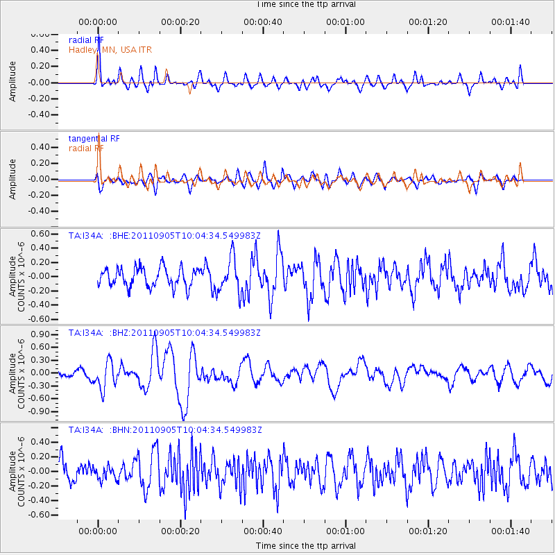
I34A Hadley, MN, USA - Earthquake Result Viewer
*The percent match for this event was below the threshold and hence no stack was calculated.
| Earthquake location: |
Tonga Islands |
| Earthquake latitude/longitude: |
-15.3/-173.6 |
| Earthquake time(UTC): |
2011/09/05 (248) 09:52:01 GMT |
| Earthquake Depth: |
37 km |
| Earthquake Magnitude: |
6.2 MB, 6.2 MS, 6.3 MW, 6.2 MW |
| Earthquake Catalog/Contributor: |
WHDF/NEIC |
|
| Network: |
TA USArray Transportable Network (new EarthScope stations) |
| Station: |
I34A Hadley, MN, USA |
| Lat/Lon: |
44.04 N/95.86 W |
| Elevation: |
509 m |
|
| Distance: |
92.0 deg |
| Az: |
44.847 deg |
| Baz: |
250.673 deg |
| Ray Param: |
$rayparam |
*The percent match for this event was below the threshold and hence was not used in the summary stack. |
|
| Radial Match: |
61.922367 % |
| Radial Bump: |
400 |
| Transverse Match: |
56.877136 % |
| Transverse Bump: |
400 |
| SOD ConfigId: |
414626 |
| Insert Time: |
2012-01-20 11:23:18.729 +0000 |
| GWidth: |
2.5 |
| Max Bumps: |
400 |
| Tol: |
0.001 |
|
Signal To Noise
| Channel | StoN | STA | LTA |
| TA:I34A: :BHZ:20110905T10:04:34.549983Z | 3.2419617 | 3.1925174E-7 | 9.847486E-8 |
| TA:I34A: :BHN:20110905T10:04:34.549983Z | 0.6339184 | 8.594144E-8 | 1.3557177E-7 |
| TA:I34A: :BHE:20110905T10:04:34.549983Z | 1.864414 | 2.4457418E-7 | 1.3118019E-7 |
| Arrivals |
| Ps | |
| PpPs | |
| PsPs/PpSs | |


