You are here: Home > Network List > TA - USArray Transportable Network (new EarthScope stations) Stations List
> Station J41A Loganville, WI, USA > Earthquake Result Viewer
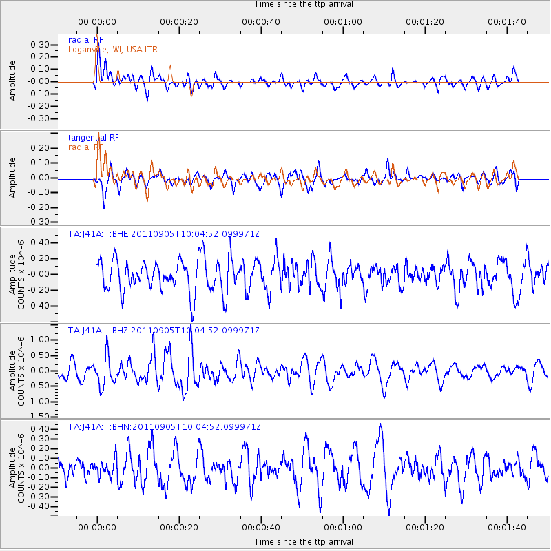
J41A Loganville, WI, USA - Earthquake Result Viewer
*The percent match for this event was below the threshold and hence no stack was calculated.
| Earthquake location: |
Tonga Islands |
| Earthquake latitude/longitude: |
-15.3/-173.6 |
| Earthquake time(UTC): |
2011/09/05 (248) 09:52:01 GMT |
| Earthquake Depth: |
37 km |
| Earthquake Magnitude: |
6.2 MB, 6.2 MS, 6.3 MW, 6.2 MW |
| Earthquake Catalog/Contributor: |
WHDF/NEIC |
|
| Network: |
TA USArray Transportable Network (new EarthScope stations) |
| Station: |
J41A Loganville, WI, USA |
| Lat/Lon: |
43.37 N/90.01 W |
| Elevation: |
360 m |
|
| Distance: |
95.8 deg |
| Az: |
46.759 deg |
| Baz: |
254.57 deg |
| Ray Param: |
$rayparam |
*The percent match for this event was below the threshold and hence was not used in the summary stack. |
|
| Radial Match: |
54.853508 % |
| Radial Bump: |
400 |
| Transverse Match: |
63.43572 % |
| Transverse Bump: |
400 |
| SOD ConfigId: |
414626 |
| Insert Time: |
2012-01-20 11:42:03.482 +0000 |
| GWidth: |
2.5 |
| Max Bumps: |
400 |
| Tol: |
0.001 |
|
Signal To Noise
| Channel | StoN | STA | LTA |
| TA:J41A: :BHZ:20110905T10:04:52.099971Z | 1.8183056 | 4.8470594E-7 | 2.665701E-7 |
| TA:J41A: :BHN:20110905T10:04:52.099971Z | 0.5521862 | 8.437486E-8 | 1.5280148E-7 |
| TA:J41A: :BHE:20110905T10:04:52.099971Z | 1.3349717 | 2.4457105E-7 | 1.8320317E-7 |
| Arrivals |
| Ps | |
| PpPs | |
| PsPs/PpSs | |


