You are here: Home > Network List > TA - USArray Transportable Network (new EarthScope stations) Stations List
> Station U41A Viola, AR, USA > Earthquake Result Viewer
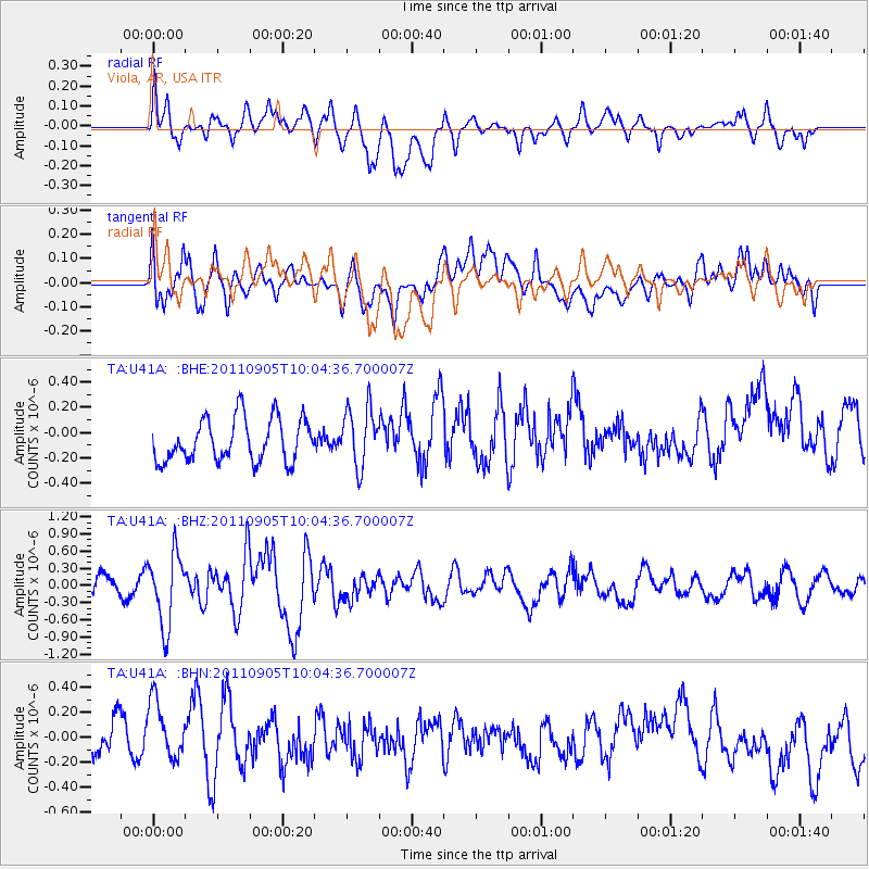
U41A Viola, AR, USA - Earthquake Result Viewer
*The percent match for this event was below the threshold and hence no stack was calculated.
| Earthquake location: |
Tonga Islands |
| Earthquake latitude/longitude: |
-15.3/-173.6 |
| Earthquake time(UTC): |
2011/09/05 (248) 09:52:01 GMT |
| Earthquake Depth: |
37 km |
| Earthquake Magnitude: |
6.2 MB, 6.2 MS, 6.3 MW, 6.2 MW |
| Earthquake Catalog/Contributor: |
WHDF/NEIC |
|
| Network: |
TA USArray Transportable Network (new EarthScope stations) |
| Station: |
U41A Viola, AR, USA |
| Lat/Lon: |
36.34 N/91.92 W |
| Elevation: |
300 m |
|
| Distance: |
92.4 deg |
| Az: |
53.094 deg |
| Baz: |
252.896 deg |
| Ray Param: |
$rayparam |
*The percent match for this event was below the threshold and hence was not used in the summary stack. |
|
| Radial Match: |
55.22858 % |
| Radial Bump: |
400 |
| Transverse Match: |
70.59502 % |
| Transverse Bump: |
400 |
| SOD ConfigId: |
414626 |
| Insert Time: |
2012-01-20 11:42:43.766 +0000 |
| GWidth: |
2.5 |
| Max Bumps: |
400 |
| Tol: |
0.001 |
|
Signal To Noise
| Channel | StoN | STA | LTA |
| TA:U41A: :BHZ:20110905T10:04:36.700007Z | 3.9177883 | 6.25795E-7 | 1.597317E-7 |
| TA:U41A: :BHN:20110905T10:04:36.700007Z | 1.8176783 | 2.624041E-7 | 1.4436222E-7 |
| TA:U41A: :BHE:20110905T10:04:36.700007Z | 1.3866544 | 2.352788E-7 | 1.6967373E-7 |
| Arrivals |
| Ps | |
| PpPs | |
| PsPs/PpSs | |


