LTY Liberty (broad-band) - Earthquake Result Viewer
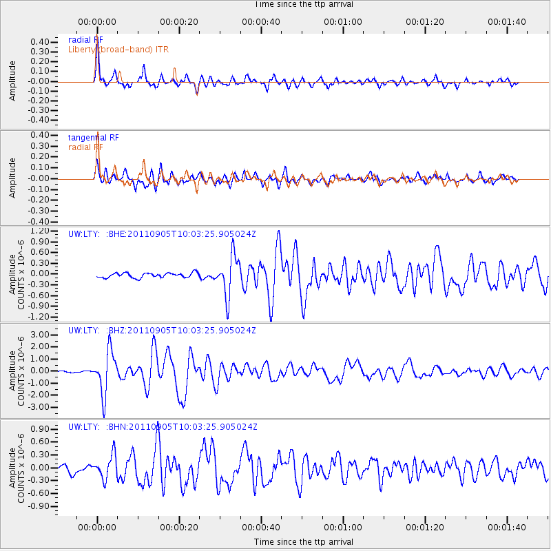
Earthquake location: Tonga Islands
Earthquake latitude/longitude: -15.3/-173.6
Earthquake time(UTC): 2011/09/05 (248) 09:52:01 GMT
Earthquake Depth: 37 km
Earthquake Magnitude: 6.2 MB, 6.2 MS, 6.3 MW, 6.2 MW
Earthquake Catalog/Contributor: WHDF/NEIC
Network: UW Pacific Northwest Regional Seismic Network
Station: LTY Liberty (broad-band)
Lat/Lon: 47.26 N/120.66 W
Elevation: 970 m
Distance: 78.2 deg
Az: 33.738 deg
Baz: 231.89 deg
Ray Param: 0.049731802
Estimated Moho Depth: 40.0 km
Estimated Crust Vp/Vs: 1.68
Assumed Crust Vp: 6.597 km/s
Estimated Crust Vs: 3.921 km/s
Estimated Crust Poisson's Ratio: 0.23
Radial Match: 90.259735 %
Radial Bump: 400
Transverse Match: 87.215645 %
Transverse Bump: 400
SOD ConfigId: 414626
Insert Time: 2012-01-20 11:48:13.847 +0000
GWidth: 2.5
Max Bumps: 400
Tol: 0.001

Signal To Noise

ChannelStoNSTALTA
UW:LTY: :BHZ:20110905T10:03:25.905024Z25.5253261.8168759E-67.117934E-8
UW:LTY: :BHN:20110905T10:03:25.905024Z2.81071522.799029E-79.958423E-8
UW:LTY: :BHE:20110905T10:03:25.905024Z8.7653915.761873E-76.573435E-8
Arrivals
Ps4.3 SECOND
PpPs16 SECOND
PsPs/PpSs20 SECOND