You are here: Home > Network List > TA - USArray Transportable Network (new EarthScope stations) Stations List
> Station D37A Cotton, MN, USA > Earthquake Result Viewer
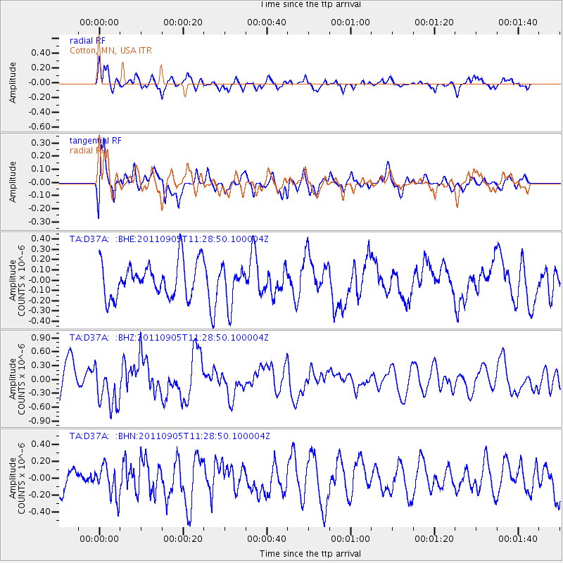
D37A Cotton, MN, USA - Earthquake Result Viewer
*The percent match for this event was below the threshold and hence no stack was calculated.
| Earthquake location: |
South Of Panama |
| Earthquake latitude/longitude: |
6.6/-82.4 |
| Earthquake time(UTC): |
2011/09/05 (248) 11:21:36 GMT |
| Earthquake Depth: |
25 km |
| Earthquake Magnitude: |
5.8 MW, 5.2 MS, 5.3 MB, 5.8 MW |
| Earthquake Catalog/Contributor: |
WHDF/NEIC |
|
| Network: |
TA USArray Transportable Network (new EarthScope stations) |
| Station: |
D37A Cotton, MN, USA |
| Lat/Lon: |
47.16 N/92.43 W |
| Elevation: |
413 m |
|
| Distance: |
41.4 deg |
| Az: |
349.598 deg |
| Baz: |
164.76 deg |
| Ray Param: |
$rayparam |
*The percent match for this event was below the threshold and hence was not used in the summary stack. |
|
| Radial Match: |
64.56858 % |
| Radial Bump: |
400 |
| Transverse Match: |
76.16336 % |
| Transverse Bump: |
400 |
| SOD ConfigId: |
414626 |
| Insert Time: |
2012-01-20 12:16:01.000 +0000 |
| GWidth: |
2.5 |
| Max Bumps: |
400 |
| Tol: |
0.001 |
|
Signal To Noise
| Channel | StoN | STA | LTA |
| TA:D37A: :BHZ:20110905T11:28:50.100004Z | 1.7582811 | 4.6503385E-7 | 2.6448208E-7 |
| TA:D37A: :BHN:20110905T11:28:50.100004Z | 0.96026 | 1.8355435E-7 | 1.9115068E-7 |
| TA:D37A: :BHE:20110905T11:28:50.100004Z | 1.122801 | 1.8861355E-7 | 1.6798487E-7 |
| Arrivals |
| Ps | |
| PpPs | |
| PsPs/PpSs | |


