You are here: Home > Network List > TA - USArray Transportable Network (new EarthScope stations) Stations List
> Station S44A Carbondale, IL, USA > Earthquake Result Viewer
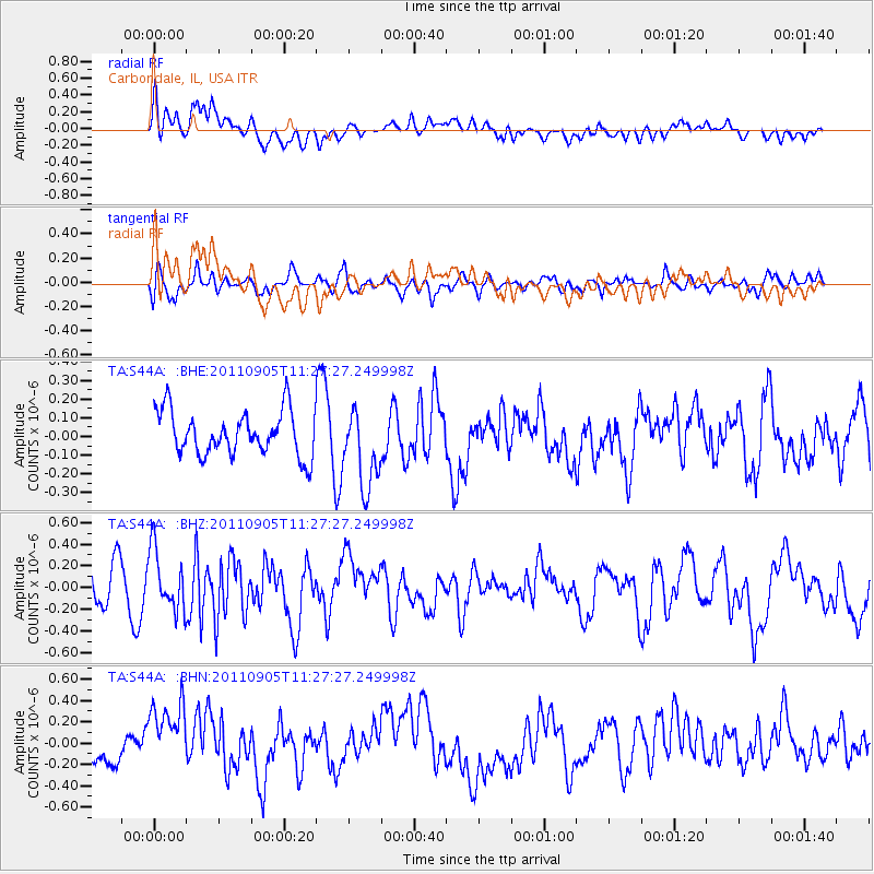
S44A Carbondale, IL, USA - Earthquake Result Viewer
*The percent match for this event was below the threshold and hence no stack was calculated.
| Earthquake location: |
South Of Panama |
| Earthquake latitude/longitude: |
6.6/-82.4 |
| Earthquake time(UTC): |
2011/09/05 (248) 11:21:36 GMT |
| Earthquake Depth: |
25 km |
| Earthquake Magnitude: |
5.8 MW, 5.2 MS, 5.3 MB, 5.8 MW |
| Earthquake Catalog/Contributor: |
WHDF/NEIC |
|
| Network: |
TA USArray Transportable Network (new EarthScope stations) |
| Station: |
S44A Carbondale, IL, USA |
| Lat/Lon: |
37.69 N/89.26 W |
| Elevation: |
155 m |
|
| Distance: |
31.6 deg |
| Az: |
349.53 deg |
| Baz: |
166.845 deg |
| Ray Param: |
$rayparam |
*The percent match for this event was below the threshold and hence was not used in the summary stack. |
|
| Radial Match: |
62.06075 % |
| Radial Bump: |
400 |
| Transverse Match: |
58.841366 % |
| Transverse Bump: |
400 |
| SOD ConfigId: |
414626 |
| Insert Time: |
2012-01-20 12:19:37.072 +0000 |
| GWidth: |
2.5 |
| Max Bumps: |
400 |
| Tol: |
0.001 |
|
Signal To Noise
| Channel | StoN | STA | LTA |
| TA:S44A: :BHZ:20110905T11:27:27.249998Z | 1.3866293 | 2.764395E-7 | 1.9936076E-7 |
| TA:S44A: :BHN:20110905T11:27:27.249998Z | 2.0124905 | 3.40682E-7 | 1.6928377E-7 |
| TA:S44A: :BHE:20110905T11:27:27.249998Z | 1.7794234 | 2.1014104E-7 | 1.1809502E-7 |
| Arrivals |
| Ps | |
| PpPs | |
| PsPs/PpSs | |


