
UTMT Martin, TN - Earthquake Result Viewer
| ||||||||||||||||||
| ||||||||||||||||||
| ||||||||||||||||||
|
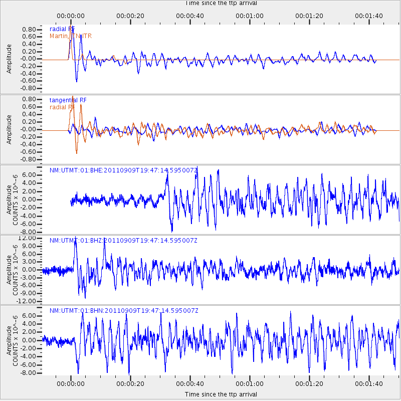
Signal To Noise
| Channel | StoN | STA | LTA |
| NM:UTMT:01:BHZ:20110909T19:47:14.595007Z | 8.593921 | 5.3816525E-6 | 6.262162E-7 |
| NM:UTMT:01:BHN:20110909T19:47:14.595007Z | 3.4672155 | 3.4001873E-6 | 9.80668E-7 |
| NM:UTMT:01:BHE:20110909T19:47:14.595007Z | 5.037116 | 3.4767309E-6 | 6.902225E-7 |
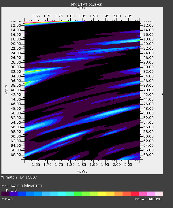
| Arrivals | |
| Ps | 1.0 SECOND |
| PpPs | 3.7 SECOND |
| PsPs/PpSs | 4.7 SECOND |

