You are here: Home > Network List > TA - USArray Transportable Network (new EarthScope stations) Stations List
> Station O56A Blue Knob State Park, Imler, PA, USA > Earthquake Result Viewer
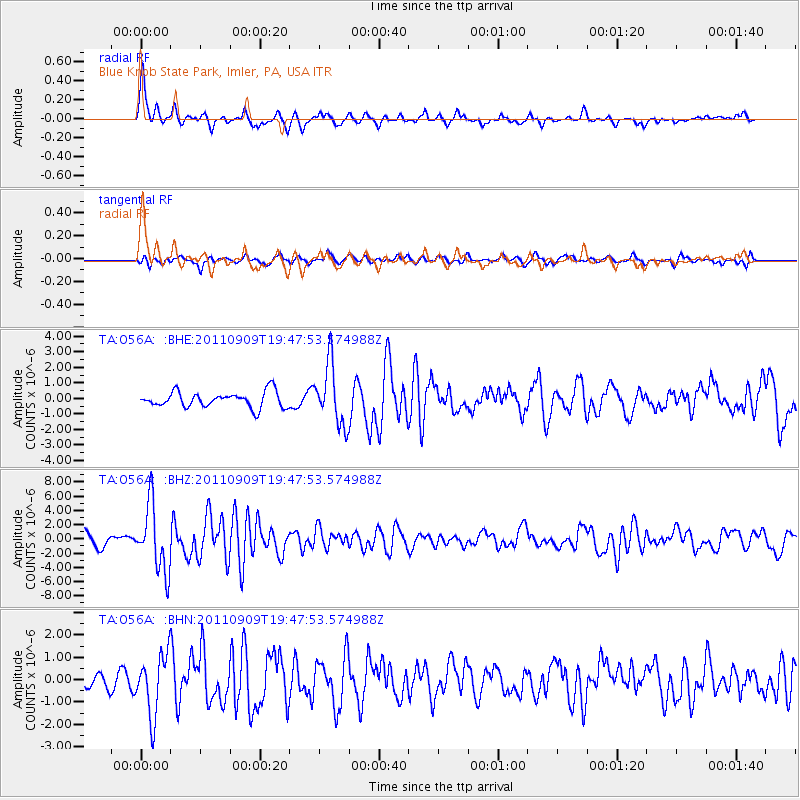
O56A Blue Knob State Park, Imler, PA, USA - Earthquake Result Viewer
*The percent match for this event was below the threshold and hence no stack was calculated.
| Earthquake location: |
Vancouver Island, Canada Region |
| Earthquake latitude/longitude: |
49.5/-126.9 |
| Earthquake time(UTC): |
2011/09/09 (252) 19:41:34 GMT |
| Earthquake Depth: |
22 km |
| Earthquake Magnitude: |
6.3 MB, 6.4 MS, 6.4 MW, 6.5 MW |
| Earthquake Catalog/Contributor: |
WHDF/NEIC |
|
| Network: |
TA USArray Transportable Network (new EarthScope stations) |
| Station: |
O56A Blue Knob State Park, Imler, PA, USA |
| Lat/Lon: |
40.27 N/78.57 W |
| Elevation: |
684 m |
|
| Distance: |
34.9 deg |
| Az: |
86.645 deg |
| Baz: |
301.788 deg |
| Ray Param: |
$rayparam |
*The percent match for this event was below the threshold and hence was not used in the summary stack. |
|
| Radial Match: |
76.30625 % |
| Radial Bump: |
400 |
| Transverse Match: |
61.70097 % |
| Transverse Bump: |
400 |
| SOD ConfigId: |
414626 |
| Insert Time: |
2012-01-20 12:55:30.300 +0000 |
| GWidth: |
2.5 |
| Max Bumps: |
400 |
| Tol: |
0.001 |
|
Signal To Noise
| Channel | StoN | STA | LTA |
| TA:O56A: :BHZ:20110909T19:47:53.574988Z | 6.948451 | 4.6582786E-6 | 6.704053E-7 |
| TA:O56A: :BHN:20110909T19:47:53.574988Z | 3.3142471 | 1.3670966E-6 | 4.1249086E-7 |
| TA:O56A: :BHE:20110909T19:47:53.574988Z | 3.86389 | 1.9352644E-6 | 5.0085913E-7 |
| Arrivals |
| Ps | |
| PpPs | |
| PsPs/PpSs | |


