You are here: Home > Network List > TA - USArray Transportable Network (new EarthScope stations) Stations List
> Station V44A Blytheville, AR, USA > Earthquake Result Viewer
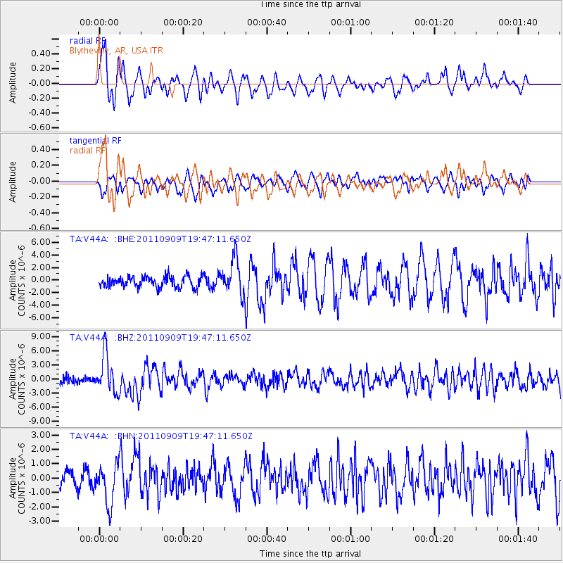
V44A Blytheville, AR, USA - Earthquake Result Viewer
*The percent match for this event was below the threshold and hence no stack was calculated.
| Earthquake location: |
Vancouver Island, Canada Region |
| Earthquake latitude/longitude: |
49.5/-126.9 |
| Earthquake time(UTC): |
2011/09/09 (252) 19:41:34 GMT |
| Earthquake Depth: |
22 km |
| Earthquake Magnitude: |
6.3 MB, 6.4 MS, 6.4 MW, 6.5 MW |
| Earthquake Catalog/Contributor: |
WHDF/NEIC |
|
| Network: |
TA USArray Transportable Network (new EarthScope stations) |
| Station: |
V44A Blytheville, AR, USA |
| Lat/Lon: |
35.83 N/89.90 W |
| Elevation: |
78 m |
|
| Distance: |
30.1 deg |
| Az: |
102.977 deg |
| Baz: |
308.626 deg |
| Ray Param: |
$rayparam |
*The percent match for this event was below the threshold and hence was not used in the summary stack. |
|
| Radial Match: |
79.6198 % |
| Radial Bump: |
400 |
| Transverse Match: |
74.21483 % |
| Transverse Bump: |
400 |
| SOD ConfigId: |
414626 |
| Insert Time: |
2012-01-20 13:01:01.545 +0000 |
| GWidth: |
2.5 |
| Max Bumps: |
400 |
| Tol: |
0.001 |
|
Signal To Noise
| Channel | StoN | STA | LTA |
| TA:V44A: :BHZ:20110909T19:47:11.650Z | 7.5077553 | 4.1966273E-6 | 5.5897226E-7 |
| TA:V44A: :BHN:20110909T19:47:11.650Z | 2.119561 | 1.4239724E-6 | 6.7182424E-7 |
| TA:V44A: :BHE:20110909T19:47:11.650Z | 3.3925433 | 2.9099422E-6 | 8.5774656E-7 |
| Arrivals |
| Ps | |
| PpPs | |
| PsPs/PpSs | |


