You are here: Home > Network List > TA - USArray Transportable Network (new EarthScope stations) Stations List
> Station X43A Marvell, AR, USA > Earthquake Result Viewer
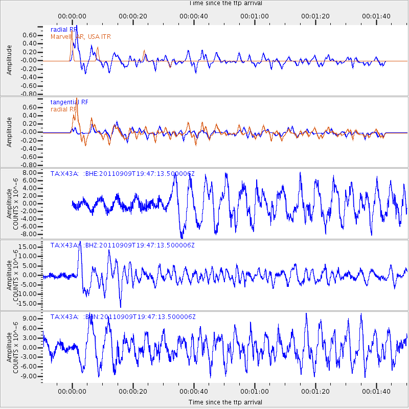
X43A Marvell, AR, USA - Earthquake Result Viewer
*The percent match for this event was below the threshold and hence no stack was calculated.
| Earthquake location: |
Vancouver Island, Canada Region |
| Earthquake latitude/longitude: |
49.5/-126.9 |
| Earthquake time(UTC): |
2011/09/09 (252) 19:41:34 GMT |
| Earthquake Depth: |
22 km |
| Earthquake Magnitude: |
6.3 MB, 6.4 MS, 6.4 MW, 6.5 MW |
| Earthquake Catalog/Contributor: |
WHDF/NEIC |
|
| Network: |
TA USArray Transportable Network (new EarthScope stations) |
| Station: |
X43A Marvell, AR, USA |
| Lat/Lon: |
34.52 N/90.88 W |
| Elevation: |
53 m |
|
| Distance: |
30.3 deg |
| Az: |
106.0 deg |
| Baz: |
310.672 deg |
| Ray Param: |
$rayparam |
*The percent match for this event was below the threshold and hence was not used in the summary stack. |
|
| Radial Match: |
89.71915 % |
| Radial Bump: |
360 |
| Transverse Match: |
73.28249 % |
| Transverse Bump: |
400 |
| SOD ConfigId: |
414626 |
| Insert Time: |
2012-01-20 13:01:26.305 +0000 |
| GWidth: |
2.5 |
| Max Bumps: |
400 |
| Tol: |
0.001 |
|
Signal To Noise
| Channel | StoN | STA | LTA |
| TA:X43A: :BHZ:20110909T19:47:13.500006Z | 11.128725 | 7.892823E-6 | 7.0922977E-7 |
| TA:X43A: :BHN:20110909T19:47:13.500006Z | 1.920537 | 3.5569649E-6 | 1.852068E-6 |
| TA:X43A: :BHE:20110909T19:47:13.500006Z | 2.9179227 | 3.581233E-6 | 1.2273227E-6 |
| Arrivals |
| Ps | |
| PpPs | |
| PsPs/PpSs | |


