You are here: Home > Network List > TA - USArray Transportable Network (new EarthScope stations) Stations List
> Station D36A Goodland, MN, USA > Earthquake Result Viewer
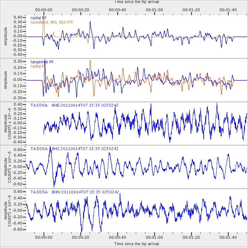
D36A Goodland, MN, USA - Earthquake Result Viewer
*The percent match for this event was below the threshold and hence no stack was calculated.
| Earthquake location: |
Near Coast Of Central Chile |
| Earthquake latitude/longitude: |
-32.7/-71.8 |
| Earthquake time(UTC): |
2011/09/14 (257) 07:03:51 GMT |
| Earthquake Depth: |
37 km |
| Earthquake Magnitude: |
5.5 MS, 5.4 MB, 5.9 MW, 5.7 MW |
| Earthquake Catalog/Contributor: |
WHDF/NEIC |
|
| Network: |
TA USArray Transportable Network (new EarthScope stations) |
| Station: |
D36A Goodland, MN, USA |
| Lat/Lon: |
47.18 N/93.16 W |
| Elevation: |
434 m |
|
| Distance: |
81.8 deg |
| Az: |
345.456 deg |
| Baz: |
161.917 deg |
| Ray Param: |
$rayparam |
*The percent match for this event was below the threshold and hence was not used in the summary stack. |
|
| Radial Match: |
38.276417 % |
| Radial Bump: |
400 |
| Transverse Match: |
55.130432 % |
| Transverse Bump: |
400 |
| SOD ConfigId: |
414626 |
| Insert Time: |
2012-01-23 09:41:42.169 +0000 |
| GWidth: |
2.5 |
| Max Bumps: |
400 |
| Tol: |
0.001 |
|
Signal To Noise
| Channel | StoN | STA | LTA |
| TA:D36A: :BHZ:20110914T07:15:35.025024Z | 2.0272007 | 3.070395E-7 | 1.5145984E-7 |
| TA:D36A: :BHN:20110914T07:15:35.025024Z | 1.2062184 | 1.5716144E-7 | 1.3029269E-7 |
| TA:D36A: :BHE:20110914T07:15:35.025024Z | 1.4985178 | 1.5222747E-7 | 1.0158536E-7 |
| Arrivals |
| Ps | |
| PpPs | |
| PsPs/PpSs | |


