You are here: Home > Network List > TA - USArray Transportable Network (new EarthScope stations) Stations List
> Station S39A Bolivar, MO, USA > Earthquake Result Viewer
S39A Bolivar, MO, USA - Earthquake Result Viewer
*The percent match for this event was below the threshold and hence no stack was calculated.
| Earthquake location: |
Near Coast Of Central Chile |
| Earthquake latitude/longitude: |
-32.7/-71.8 |
| Earthquake time(UTC): |
2011/09/14 (257) 07:03:51 GMT |
| Earthquake Depth: |
37 km |
| Earthquake Magnitude: |
5.5 MS, 5.4 MB, 5.9 MW, 5.7 MW |
| Earthquake Catalog/Contributor: |
WHDF/NEIC |
|
| Network: |
TA USArray Transportable Network (new EarthScope stations) |
| Station: |
S39A Bolivar, MO, USA |
| Lat/Lon: |
37.69 N/93.32 W |
| Elevation: |
331 m |
|
| Distance: |
72.8 deg |
| Az: |
342.264 deg |
| Baz: |
161.108 deg |
| Ray Param: |
$rayparam |
*The percent match for this event was below the threshold and hence was not used in the summary stack. |
|
| Radial Match: |
61.454037 % |
| Radial Bump: |
400 |
| Transverse Match: |
70.77763 % |
| Transverse Bump: |
400 |
| SOD ConfigId: |
414626 |
| Insert Time: |
2012-01-23 09:43:36.066 +0000 |
| GWidth: |
2.5 |
| Max Bumps: |
400 |
| Tol: |
0.001 |
|
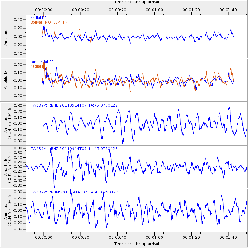
Signal To Noise
| Channel | StoN | STA | LTA |
| TA:S39A: :BHZ:20110914T07:14:45.075012Z | 2.928253 | 3.3503605E-7 | 1.14415E-7 |
| TA:S39A: :BHN:20110914T07:14:45.075012Z | 0.9682015 | 1.18568856E-7 | 1.2246299E-7 |
| TA:S39A: :BHE:20110914T07:14:45.075012Z | 1.5979445 | 1.3215677E-7 | 8.270423E-8 |
| Arrivals |
| Ps | |
| PpPs | |
| PsPs/PpSs | |


