You are here: Home > Network List > CI - Caltech Regional Seismic Network Stations List
> Station MPM Manuel Prospect Mine, California, USA > Earthquake Result Viewer
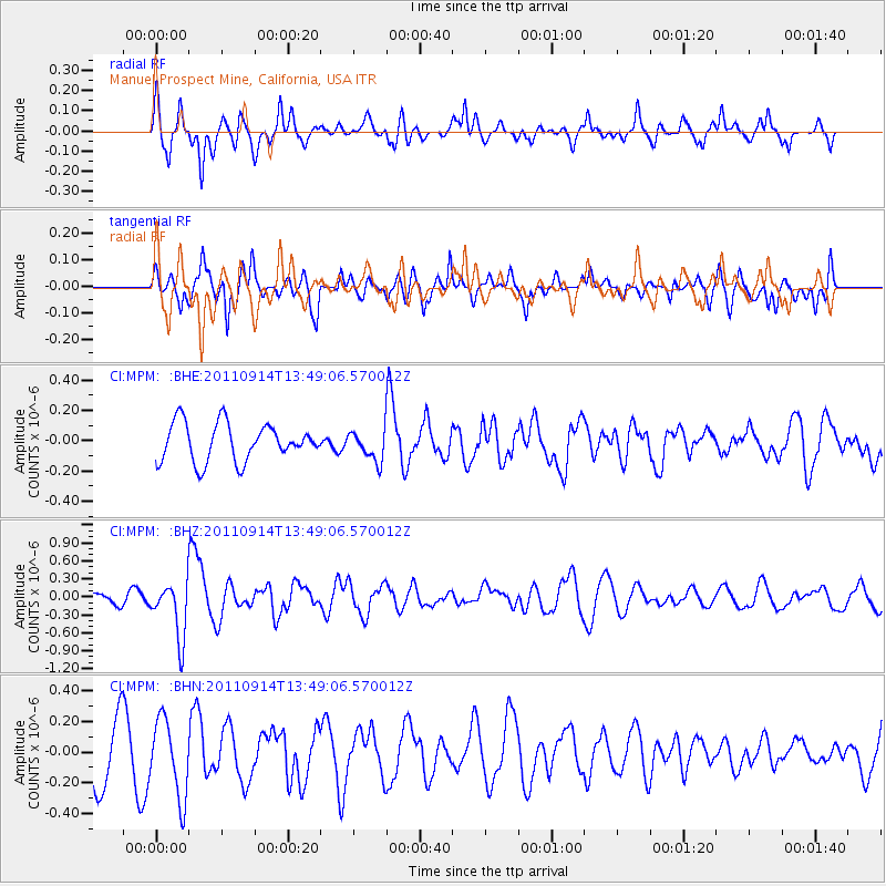
MPM Manuel Prospect Mine, California, USA - Earthquake Result Viewer
*The percent match for this event was below the threshold and hence no stack was calculated.
| Earthquake location: |
East Of North Island, N.Z. |
| Earthquake latitude/longitude: |
-35.1/-179.0 |
| Earthquake time(UTC): |
2011/09/14 (257) 13:36:34 GMT |
| Earthquake Depth: |
13 km |
| Earthquake Magnitude: |
5.6 MB, 5.6 MS, 5.7 MW |
| Earthquake Catalog/Contributor: |
WHDF/NEIC |
|
| Network: |
CI Caltech Regional Seismic Network |
| Station: |
MPM Manuel Prospect Mine, California, USA |
| Lat/Lon: |
36.06 N/117.49 W |
| Elevation: |
185 m |
|
| Distance: |
91.1 deg |
| Az: |
45.417 deg |
| Baz: |
226.107 deg |
| Ray Param: |
$rayparam |
*The percent match for this event was below the threshold and hence was not used in the summary stack. |
|
| Radial Match: |
68.243355 % |
| Radial Bump: |
400 |
| Transverse Match: |
62.61237 % |
| Transverse Bump: |
400 |
| SOD ConfigId: |
414626 |
| Insert Time: |
2012-01-23 09:59:51.418 +0000 |
| GWidth: |
2.5 |
| Max Bumps: |
400 |
| Tol: |
0.001 |
|
Signal To Noise
| Channel | StoN | STA | LTA |
| CI:MPM: :BHZ:20110914T13:49:06.570012Z | 5.065988 | 4.7159867E-7 | 9.309116E-8 |
| CI:MPM: :BHN:20110914T13:49:06.570012Z | 1.2852567 | 2.530127E-7 | 1.9685771E-7 |
| CI:MPM: :BHE:20110914T13:49:06.570012Z | 0.8190881 | 1.0127561E-7 | 1.2364434E-7 |
| Arrivals |
| Ps | |
| PpPs | |
| PsPs/PpSs | |


