You are here: Home > Network List > TA - USArray Transportable Network (new EarthScope stations) Stations List
> Station MDND Maddock, ND, USA > Earthquake Result Viewer
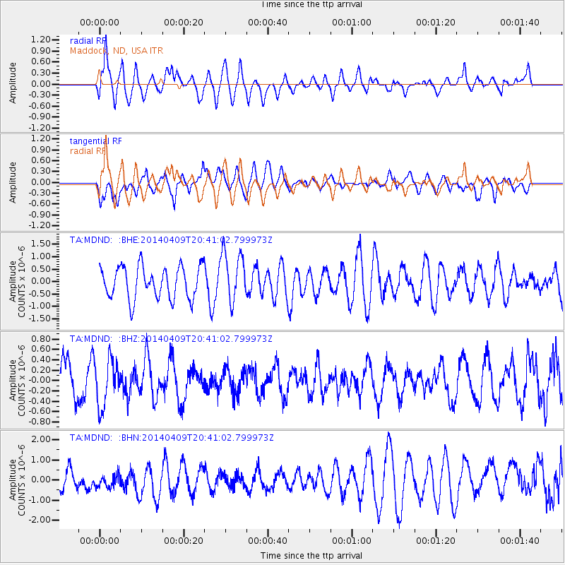
MDND Maddock, ND, USA - Earthquake Result Viewer
*The percent match for this event was below the threshold and hence no stack was calculated.
| Earthquake location: |
Fiji Islands Region |
| Earthquake latitude/longitude: |
-14.7/-176.0 |
| Earthquake time(UTC): |
2014/04/09 (099) 20:29:02 GMT |
| Earthquake Depth: |
327 km |
| Earthquake Magnitude: |
5.5 MW |
| Earthquake Catalog/Contributor: |
ISC/ISC |
|
| Network: |
TA USArray Transportable Network (new EarthScope stations) |
| Station: |
MDND Maddock, ND, USA |
| Lat/Lon: |
47.85 N/99.60 W |
| Elevation: |
479 m |
|
| Distance: |
91.9 deg |
| Az: |
40.931 deg |
| Baz: |
250.266 deg |
| Ray Param: |
$rayparam |
*The percent match for this event was below the threshold and hence was not used in the summary stack. |
|
| Radial Match: |
70.14351 % |
| Radial Bump: |
400 |
| Transverse Match: |
53.222008 % |
| Transverse Bump: |
400 |
| SOD ConfigId: |
3390531 |
| Insert Time: |
2019-04-11 06:02:33.726 +0000 |
| GWidth: |
2.5 |
| Max Bumps: |
400 |
| Tol: |
0.001 |
|
Signal To Noise
| Channel | StoN | STA | LTA |
| TA:MDND: :BHZ:20140409T20:41:02.799973Z | 1.4592648 | 4.5723368E-7 | 3.1333155E-7 |
| TA:MDND: :BHN:20140409T20:41:02.799973Z | 0.6938528 | 4.0130922E-7 | 5.7837804E-7 |
| TA:MDND: :BHE:20140409T20:41:02.799973Z | 1.5750082 | 1.018614E-6 | 6.4673566E-7 |
| Arrivals |
| Ps | |
| PpPs | |
| PsPs/PpSs | |


