You are here: Home > Network List > TA - USArray Transportable Network (new EarthScope stations) Stations List
> Station 833A Chaparral WMA, Artesia Wells, TX, USA > Earthquake Result Viewer
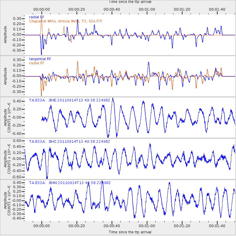
833A Chaparral WMA, Artesia Wells, TX, USA - Earthquake Result Viewer
*The percent match for this event was below the threshold and hence no stack was calculated.
| Earthquake location: |
East Of North Island, N.Z. |
| Earthquake latitude/longitude: |
-35.1/-179.0 |
| Earthquake time(UTC): |
2011/09/14 (257) 13:36:34 GMT |
| Earthquake Depth: |
13 km |
| Earthquake Magnitude: |
5.6 MB, 5.6 MS, 5.7 MW |
| Earthquake Catalog/Contributor: |
WHDF/NEIC |
|
| Network: |
TA USArray Transportable Network (new EarthScope stations) |
| Station: |
833A Chaparral WMA, Artesia Wells, TX, USA |
| Lat/Lon: |
28.32 N/99.39 W |
| Elevation: |
171 m |
|
| Distance: |
98.0 deg |
| Az: |
61.129 deg |
| Baz: |
234.525 deg |
| Ray Param: |
$rayparam |
*The percent match for this event was below the threshold and hence was not used in the summary stack. |
|
| Radial Match: |
52.452866 % |
| Radial Bump: |
400 |
| Transverse Match: |
39.640186 % |
| Transverse Bump: |
380 |
| SOD ConfigId: |
414626 |
| Insert Time: |
2012-01-23 10:05:23.525 +0000 |
| GWidth: |
2.5 |
| Max Bumps: |
400 |
| Tol: |
0.001 |
|
Signal To Noise
| Channel | StoN | STA | LTA |
| TA:833A: :BHZ:20110914T13:49:38.22498Z | 1.6209943 | 3.2108335E-7 | 1.9807803E-7 |
| TA:833A: :BHN:20110914T13:49:38.22498Z | 1.020966 | 9.230893E-8 | 9.041332E-8 |
| TA:833A: :BHE:20110914T13:49:38.22498Z | 1.1177442 | 1.5543594E-7 | 1.3906218E-7 |
| Arrivals |
| Ps | |
| PpPs | |
| PsPs/PpSs | |


