You are here: Home > Network List > CI - Caltech Regional Seismic Network Stations List
> Station GLA Glamis, Glamis, CA, USA > Earthquake Result Viewer
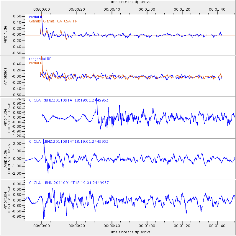
GLA Glamis, Glamis, CA, USA - Earthquake Result Viewer
*The percent match for this event was below the threshold and hence no stack was calculated.
| Earthquake location: |
Near Islands, Aleutian Islands |
| Earthquake latitude/longitude: |
53.1/173.0 |
| Earthquake time(UTC): |
2011/09/14 (257) 18:10:09 GMT |
| Earthquake Depth: |
15 km |
| Earthquake Magnitude: |
6.1 MB, 5.7 MS, 6.0 MW, 6.0 MW |
| Earthquake Catalog/Contributor: |
WHDF/NEIC |
|
| Network: |
CI Caltech Regional Seismic Network |
| Station: |
GLA Glamis, Glamis, CA, USA |
| Lat/Lon: |
33.05 N/114.83 W |
| Elevation: |
610 m |
|
| Distance: |
54.0 deg |
| Az: |
81.303 deg |
| Baz: |
314.797 deg |
| Ray Param: |
$rayparam |
*The percent match for this event was below the threshold and hence was not used in the summary stack. |
|
| Radial Match: |
77.253006 % |
| Radial Bump: |
400 |
| Transverse Match: |
72.566086 % |
| Transverse Bump: |
400 |
| SOD ConfigId: |
414626 |
| Insert Time: |
2012-01-23 10:14:28.913 +0000 |
| GWidth: |
2.5 |
| Max Bumps: |
400 |
| Tol: |
0.001 |
|
Signal To Noise
| Channel | StoN | STA | LTA |
| CI:GLA: :BHZ:20110914T18:19:01.244995Z | 6.0863986 | 9.88765E-7 | 1.6245485E-7 |
| CI:GLA: :BHN:20110914T18:19:01.244995Z | 2.9368336 | 3.9108875E-7 | 1.3316681E-7 |
| CI:GLA: :BHE:20110914T18:19:01.244995Z | 3.9469748 | 4.7674538E-7 | 1.2078755E-7 |
| Arrivals |
| Ps | |
| PpPs | |
| PsPs/PpSs | |


