You are here: Home > Network List > IW - Intermountain West Stations List
> Station DLMT Dillon, Montana, USA > Earthquake Result Viewer
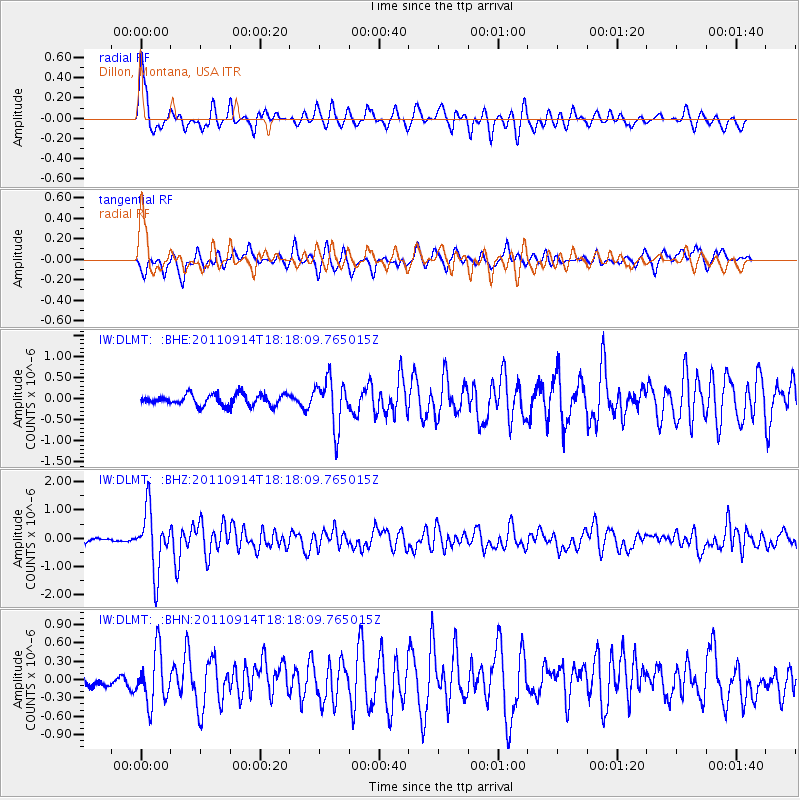
DLMT Dillon, Montana, USA - Earthquake Result Viewer
*The percent match for this event was below the threshold and hence no stack was calculated.
| Earthquake location: |
Near Islands, Aleutian Islands |
| Earthquake latitude/longitude: |
53.1/173.0 |
| Earthquake time(UTC): |
2011/09/14 (257) 18:10:09 GMT |
| Earthquake Depth: |
15 km |
| Earthquake Magnitude: |
6.1 MB, 5.7 MS, 6.0 MW, 6.0 MW |
| Earthquake Catalog/Contributor: |
WHDF/NEIC |
|
| Network: |
IW Intermountain West |
| Station: |
DLMT Dillon, Montana, USA |
| Lat/Lon: |
45.36 N/112.60 W |
| Elevation: |
1569 m |
|
| Distance: |
47.2 deg |
| Az: |
67.845 deg |
| Baz: |
307.624 deg |
| Ray Param: |
$rayparam |
*The percent match for this event was below the threshold and hence was not used in the summary stack. |
|
| Radial Match: |
68.44575 % |
| Radial Bump: |
400 |
| Transverse Match: |
59.7276 % |
| Transverse Bump: |
395 |
| SOD ConfigId: |
414626 |
| Insert Time: |
2012-01-23 10:21:47.765 +0000 |
| GWidth: |
2.5 |
| Max Bumps: |
400 |
| Tol: |
0.001 |
|
Signal To Noise
| Channel | StoN | STA | LTA |
| IW:DLMT: :BHZ:20110914T18:18:09.765015Z | 16.309898 | 1.0630107E-6 | 6.5175804E-8 |
| IW:DLMT: :BHN:20110914T18:18:09.765015Z | 3.4956617 | 4.2177783E-7 | 1.206575E-7 |
| IW:DLMT: :BHE:20110914T18:18:09.765015Z | 4.298813 | 5.6150543E-7 | 1.3061872E-7 |
| Arrivals |
| Ps | |
| PpPs | |
| PsPs/PpSs | |


