
MSTX Muleshoe, TX, USA - Earthquake Result Viewer
| ||||||||||||||||||
| ||||||||||||||||||
| ||||||||||||||||||
|
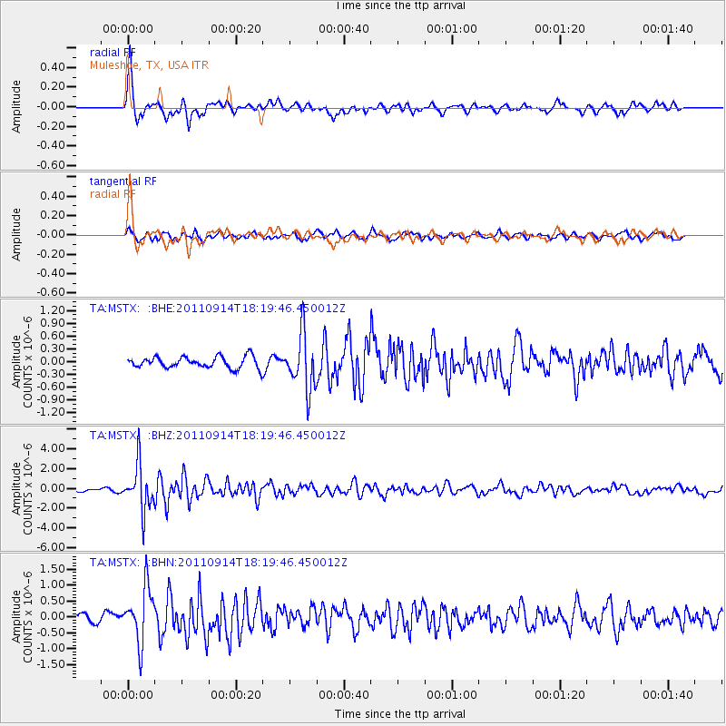
Signal To Noise
| Channel | StoN | STA | LTA |
| TA:MSTX: :BHZ:20110914T18:19:46.450012Z | 15.271802 | 2.2977297E-6 | 1.504557E-7 |
| TA:MSTX: :BHN:20110914T18:19:46.450012Z | 7.13761 | 8.7086494E-7 | 1.2201072E-7 |
| TA:MSTX: :BHE:20110914T18:19:46.450012Z | 4.891896 | 6.536363E-7 | 1.3361615E-7 |
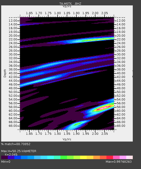
| Arrivals | |
| Ps | 10 SECOND |
| PpPs | 28 SECOND |
| PsPs/PpSs | 38 SECOND |

