T25A Trinidad, CO, USA - Earthquake Result Viewer
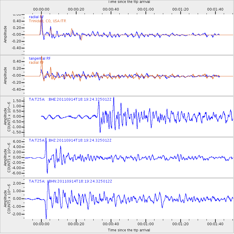
Earthquake location: Near Islands, Aleutian Islands
Earthquake latitude/longitude: 53.1/173.0
Earthquake time(UTC): 2011/09/14 (257) 18:10:09 GMT
Earthquake Depth: 15 km
Earthquake Magnitude: 6.1 MB, 5.7 MS, 6.0 MW, 6.0 MW
Earthquake Catalog/Contributor: WHDF/NEIC
Network: TA USArray Transportable Network (new EarthScope stations)
Station: T25A Trinidad, CO, USA
Lat/Lon: 37.14 N/104.41 W
Elevation: 2017 m
Distance: 57.2 deg
Az: 70.515 deg
Baz: 314.663 deg
Ray Param: 0.06362759
Estimated Moho Depth: 52.0 km
Estimated Crust Vp/Vs: 1.64
Assumed Crust Vp: 6.316 km/s
Estimated Crust Vs: 3.851 km/s
Estimated Crust Poisson's Ratio: 0.20
Radial Match: 90.94558 %
Radial Bump: 395
Transverse Match: 85.186226 %
Transverse Bump: 400
SOD ConfigId: 414626
Insert Time: 2012-01-23 10:28:37.721 +0000
GWidth: 2.5
Max Bumps: 400
Tol: 0.001

Signal To Noise

ChannelStoNSTALTA
TA:T25A: :BHZ:20110914T18:19:24.325012Z25.9752142.6436662E-61.0177649E-7
TA:T25A: :BHN:20110914T18:19:24.325012Z19.295291.0743269E-65.5678196E-8
TA:T25A: :BHE:20110914T18:19:24.325012Z6.50810676.344612E-79.748783E-8
Arrivals
Ps5.6 SECOND
PpPs21 SECOND
PsPs/PpSs26 SECOND