
MDND Maddock, ND, USA - Earthquake Result Viewer
| ||||||||||||||||||
| ||||||||||||||||||
| ||||||||||||||||||
|
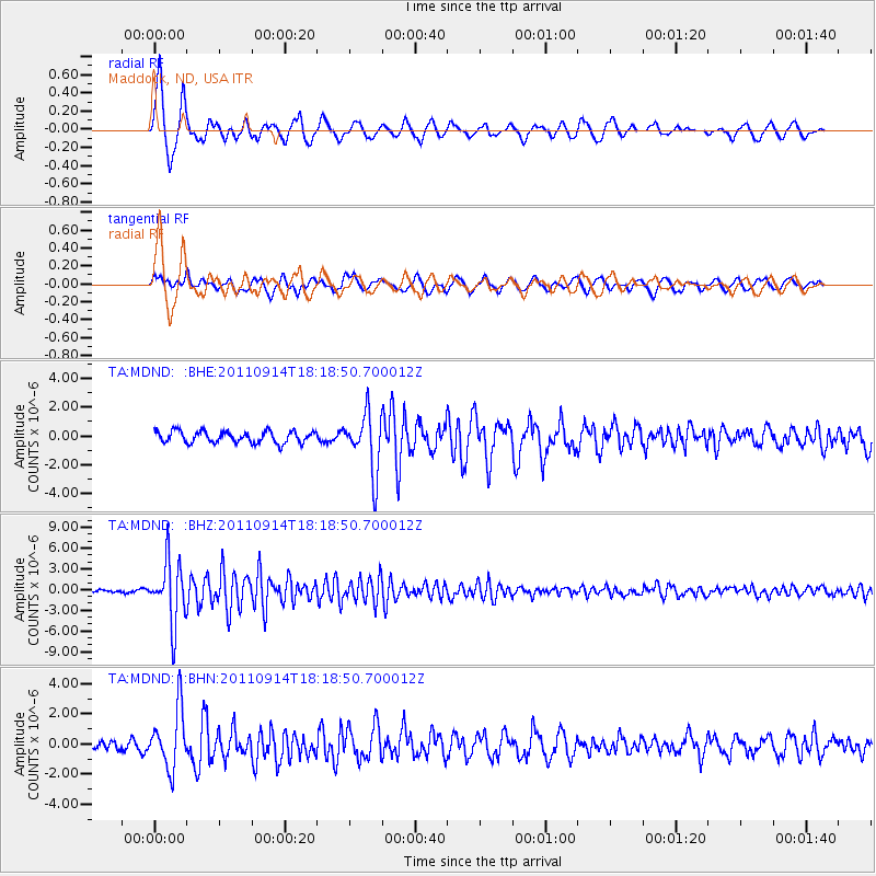
Signal To Noise
| Channel | StoN | STA | LTA |
| TA:MDND: :BHZ:20110914T18:18:50.700012Z | 31.021128 | 4.4656967E-6 | 1.4395663E-7 |
| TA:MDND: :BHN:20110914T18:18:50.700012Z | 6.0229077 | 1.9611882E-6 | 3.256215E-7 |
| TA:MDND: :BHE:20110914T18:18:50.700012Z | 5.0017033 | 2.0267062E-6 | 4.052032E-7 |
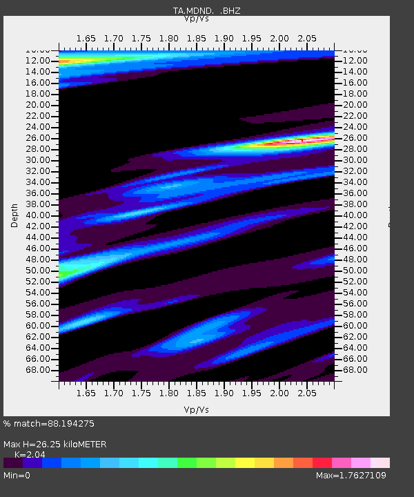
| Arrivals | |
| Ps | 4.4 SECOND |
| PpPs | 12 SECOND |
| PsPs/PpSs | 16 SECOND |

