
TUL1 Leonard, OK, USA - Earthquake Result Viewer
| ||||||||||||||||||
| ||||||||||||||||||
| ||||||||||||||||||
|
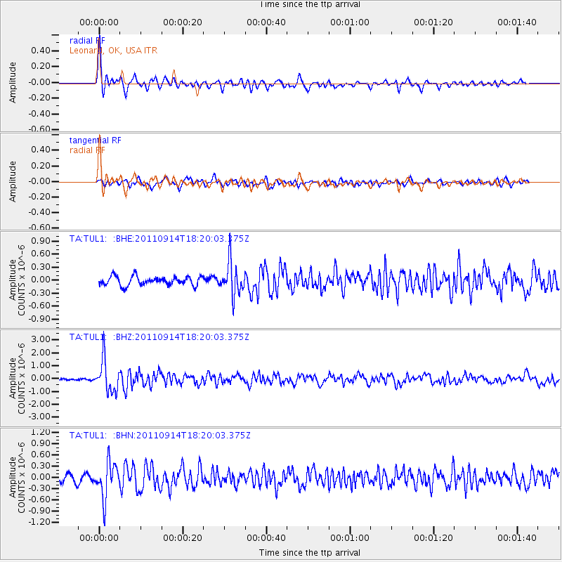
Signal To Noise
| Channel | StoN | STA | LTA |
| TA:TUL1: :BHZ:20110914T18:20:03.375Z | 13.032761 | 1.2520155E-6 | 9.60668E-8 |
| TA:TUL1: :BHN:20110914T18:20:03.375Z | 4.385881 | 4.809189E-7 | 1.0965161E-7 |
| TA:TUL1: :BHE:20110914T18:20:03.375Z | 3.6892123 | 3.7822218E-7 | 1.0252112E-7 |
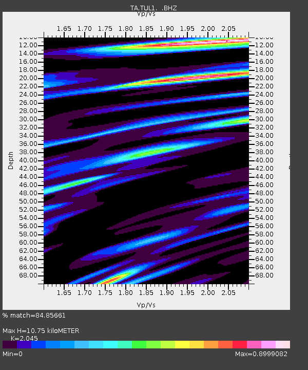
| Arrivals | |
| Ps | 1.8 SECOND |
| PpPs | 4.8 SECOND |
| PsPs/PpSs | 6.6 SECOND |

