
BGNE Belgrade, NE, USA - Earthquake Result Viewer
| ||||||||||||||||||
| ||||||||||||||||||
| ||||||||||||||||||
|
Signal To Noise
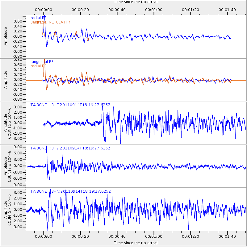
| Channel | StoN | STA | LTA |
| TA:BGNE: :BHZ:20110914T18:19:27.625Z | 23.19681 | 3.2756993E-6 | 1.4121336E-7 |
| TA:BGNE: :BHN:20110914T18:19:27.625Z | 7.7997174 | 1.7745476E-6 | 2.2751435E-7 |
| TA:BGNE: :BHE:20110914T18:19:27.625Z | 7.377417 | 1.8002313E-6 | 2.4401916E-7 |
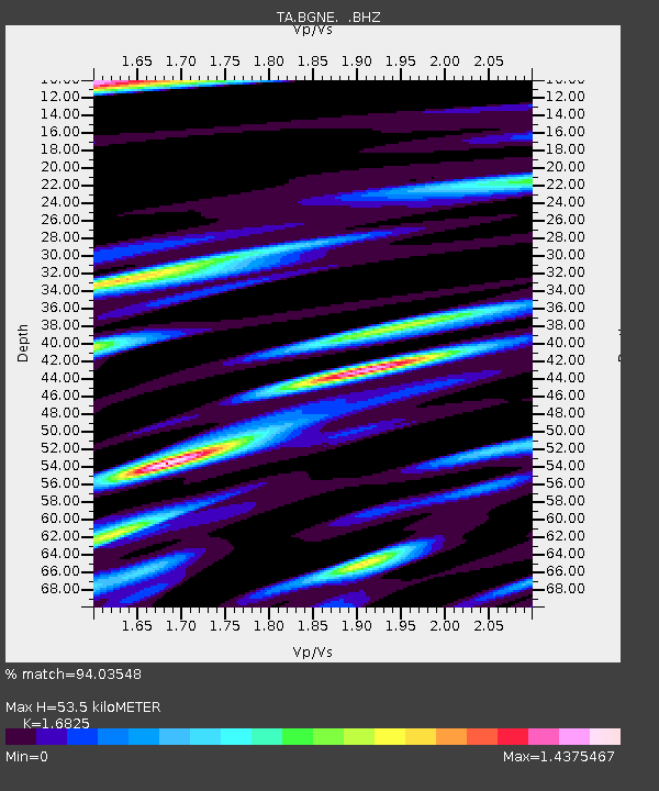
| Arrivals | |
| Ps | 5.9 SECOND |
| PpPs | 21 SECOND |
| PsPs/PpSs | 27 SECOND |

