
534A Blanco, TX, USA - Earthquake Result Viewer
| ||||||||||||||||||
| ||||||||||||||||||
| ||||||||||||||||||
|
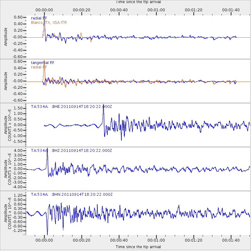
Signal To Noise
| Channel | StoN | STA | LTA |
| TA:534A: :BHZ:20110914T18:20:22.000Z | 16.145308 | 1.4641688E-6 | 9.068695E-8 |
| TA:534A: :BHN:20110914T18:20:22.000Z | 6.140358 | 4.6585347E-7 | 7.5867476E-8 |
| TA:534A: :BHE:20110914T18:20:22.000Z | 9.563394 | 6.314235E-7 | 6.6025045E-8 |
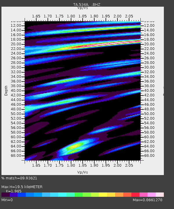
| Arrivals | |
| Ps | 3.0 SECOND |
| PpPs | 8.6 SECOND |
| PsPs/PpSs | 12 SECOND |

