535A Dale, TX, USA - Earthquake Result Viewer
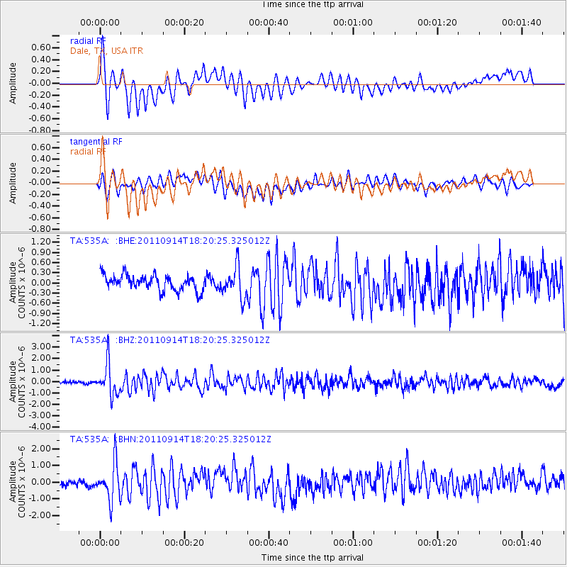
Earthquake location: Near Islands, Aleutian Islands
Earthquake latitude/longitude: 53.1/173.0
Earthquake time(UTC): 2011/09/14 (257) 18:10:09 GMT
Earthquake Depth: 15 km
Earthquake Magnitude: 6.1 MB, 5.7 MS, 6.0 MW, 6.0 MW
Earthquake Catalog/Contributor: WHDF/NEIC
Network: TA USArray Transportable Network (new EarthScope stations)
Station: 535A Dale, TX, USA
Lat/Lon: 30.03 N/97.57 W
Elevation: 170 m
Distance: 66.3 deg
Az: 71.302 deg
Baz: 318.813 deg
Ray Param: 0.05771119
Estimated Moho Depth: 16.75 km
Estimated Crust Vp/Vs: 2.10
Assumed Crust Vp: 6.347 km/s
Estimated Crust Vs: 3.026 km/s
Estimated Crust Poisson's Ratio: 0.35
Radial Match: 80.656364 %
Radial Bump: 400
Transverse Match: 64.688576 %
Transverse Bump: 400
SOD ConfigId: 414626
Insert Time: 2012-01-23 10:32:17.977 +0000
GWidth: 2.5
Max Bumps: 400
Tol: 0.001

Signal To Noise

ChannelStoNSTALTA
TA:535A: :BHZ:20110914T18:20:25.325012Z17.0506061.4190069E-68.3223256E-8
TA:535A: :BHN:20110914T18:20:25.325012Z6.813411.1420512E-61.6761817E-7
TA:535A: :BHE:20110914T18:20:25.325012Z2.08301194.720626E-72.26625E-7
Arrivals
Ps3.0 SECOND
PpPs7.9 SECOND
PsPs/PpSs11 SECOND