You are here: Home > Network List > TA - USArray Transportable Network (new EarthScope stations) Stations List
> Station J46A Howard City, MI, USA > Earthquake Result Viewer
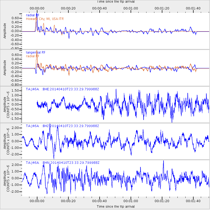
J46A Howard City, MI, USA - Earthquake Result Viewer
*The percent match for this event was below the threshold and hence no stack was calculated.
| Earthquake location: |
Nicaragua |
| Earthquake latitude/longitude: |
12.5/-86.4 |
| Earthquake time(UTC): |
2014/04/10 (100) 23:27:46 GMT |
| Earthquake Depth: |
13 km |
| Earthquake Magnitude: |
6.1 MWP, 6.0 MWB |
| Earthquake Catalog/Contributor: |
NEIC PDE/NEIC COMCAT |
|
| Network: |
TA USArray Transportable Network (new EarthScope stations) |
| Station: |
J46A Howard City, MI, USA |
| Lat/Lon: |
43.35 N/85.65 W |
| Elevation: |
275 m |
|
| Distance: |
30.7 deg |
| Az: |
1.045 deg |
| Baz: |
181.4 deg |
| Ray Param: |
$rayparam |
*The percent match for this event was below the threshold and hence was not used in the summary stack. |
|
| Radial Match: |
76.36473 % |
| Radial Bump: |
400 |
| Transverse Match: |
73.21018 % |
| Transverse Bump: |
400 |
| SOD ConfigId: |
3390531 |
| Insert Time: |
2019-04-11 06:14:27.656 +0000 |
| GWidth: |
2.5 |
| Max Bumps: |
400 |
| Tol: |
0.001 |
|
Signal To Noise
| Channel | StoN | STA | LTA |
| TA:J46A: :BHZ:20140410T23:33:29.799988Z | 2.119084 | 8.3805486E-7 | 3.954798E-7 |
| TA:J46A: :BHN:20140410T23:33:29.799988Z | 2.6778042 | 1.0513585E-6 | 3.9261963E-7 |
| TA:J46A: :BHE:20140410T23:33:29.799988Z | 1.2486452 | 4.2007758E-7 | 3.364267E-7 |
| Arrivals |
| Ps | |
| PpPs | |
| PsPs/PpSs | |


