336A Riesel, TX, USA - Earthquake Result Viewer
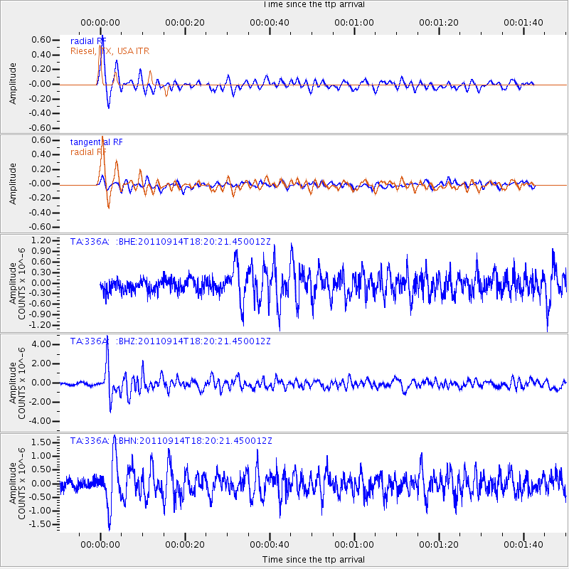
Earthquake location: Near Islands, Aleutian Islands
Earthquake latitude/longitude: 53.1/173.0
Earthquake time(UTC): 2011/09/14 (257) 18:10:09 GMT
Earthquake Depth: 15 km
Earthquake Magnitude: 6.1 MB, 5.7 MS, 6.0 MW, 6.0 MW
Earthquake Catalog/Contributor: WHDF/NEIC
Network: TA USArray Transportable Network (new EarthScope stations)
Station: 336A Riesel, TX, USA
Lat/Lon: 31.39 N/96.84 W
Elevation: 140 m
Distance: 65.7 deg
Az: 69.809 deg
Baz: 318.575 deg
Ray Param: 0.058106657
Estimated Moho Depth: 10.5 km
Estimated Crust Vp/Vs: 1.60
Assumed Crust Vp: 6.347 km/s
Estimated Crust Vs: 3.967 km/s
Estimated Crust Poisson's Ratio: 0.18
Radial Match: 89.64495 %
Radial Bump: 386
Transverse Match: 66.17537 %
Transverse Bump: 400
SOD ConfigId: 414626
Insert Time: 2012-01-23 10:34:04.088 +0000
GWidth: 2.5
Max Bumps: 400
Tol: 0.001

Signal To Noise

ChannelStoNSTALTA
TA:336A: :BHZ:20110914T18:20:21.450012Z19.4241241.6248895E-68.365317E-8
TA:336A: :BHN:20110914T18:20:21.450012Z5.10735858.536052E-71.6713243E-7
TA:336A: :BHE:20110914T18:20:21.450012Z2.97158465.052614E-71.7003097E-7
Arrivals
Ps1.0 SECOND
PpPs4.1 SECOND
PsPs/PpSs5.2 SECOND