
Y35A Marietta, OK, USA - Earthquake Result Viewer
| ||||||||||||||||||
| ||||||||||||||||||
| ||||||||||||||||||
|
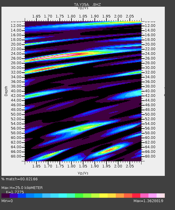
Signal To Noise
| Channel | StoN | STA | LTA |
| TA:Y35A: :BHZ:20110914T18:20:08.549988Z | 13.837733 | 1.760282E-6 | 1.2720884E-7 |
| TA:Y35A: :BHN:20110914T18:20:08.549988Z | 4.3743577 | 5.818348E-7 | 1.3301033E-7 |
| TA:Y35A: :BHE:20110914T18:20:08.549988Z | 1.5951102 | 3.399196E-7 | 2.1310102E-7 |
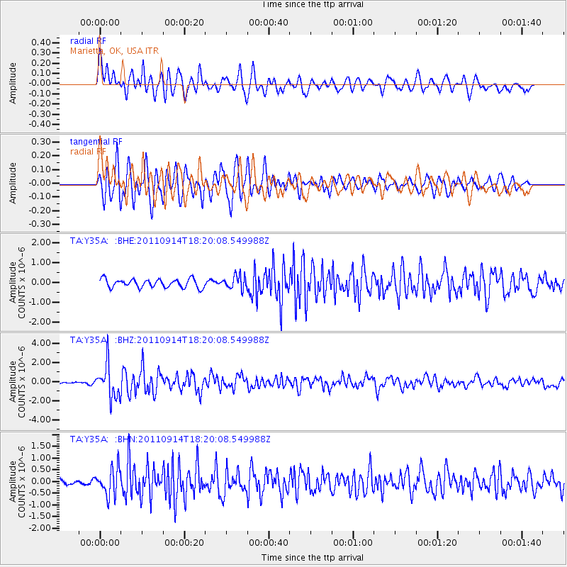
| Arrivals | |
| Ps | 3.0 SECOND |
| PpPs | 10 SECOND |
| PsPs/PpSs | 13 SECOND |

