
O33A Hebron, NE, USA - Earthquake Result Viewer
| ||||||||||||||||||
| ||||||||||||||||||
| ||||||||||||||||||
|
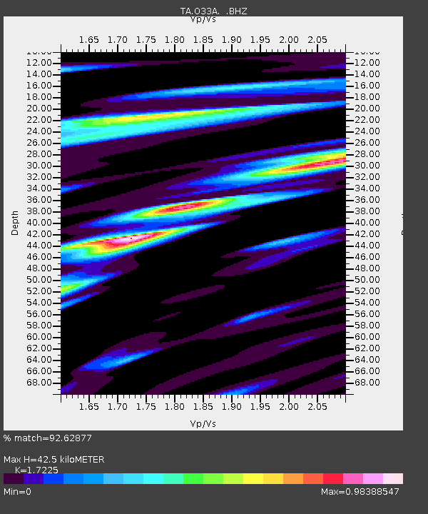
Signal To Noise
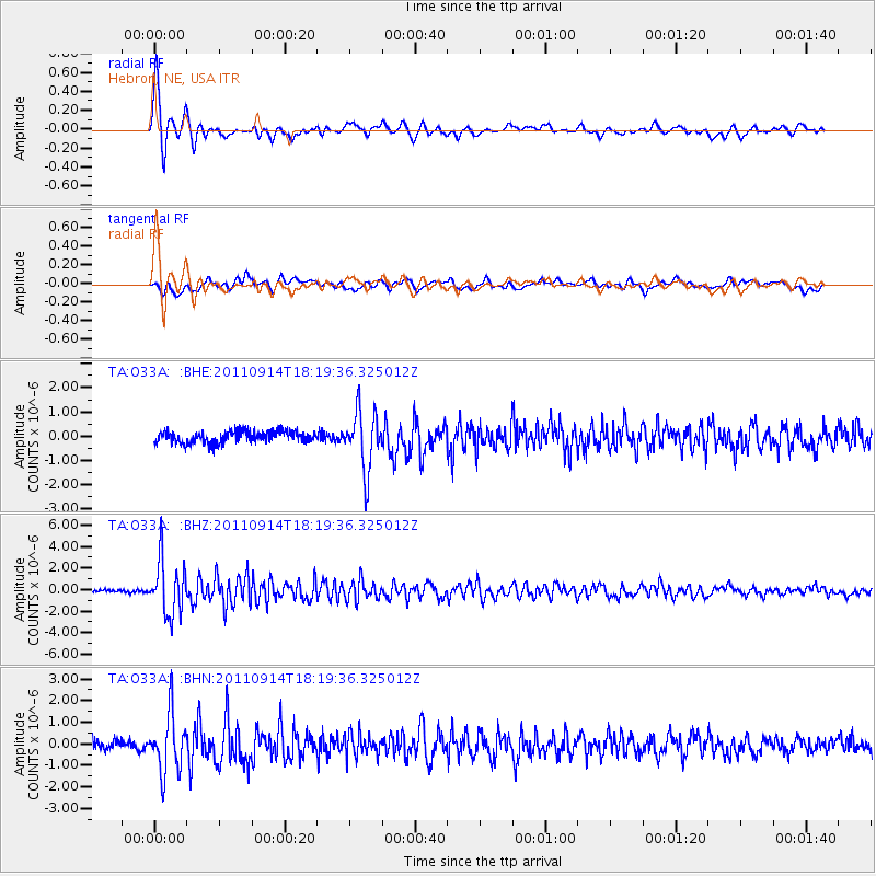
| Channel | StoN | STA | LTA |
| TA:O33A: :BHZ:20110914T18:19:36.325012Z | 26.705557 | 2.5269446E-6 | 9.462242E-8 |
| TA:O33A: :BHN:20110914T18:19:36.325012Z | 4.6612744 | 1.3387835E-6 | 2.8721405E-7 |
| TA:O33A: :BHE:20110914T18:19:36.325012Z | 4.9350734 | 1.1975552E-6 | 2.4266208E-7 |
| Arrivals | |
| Ps | 5.0 SECOND |
| PpPs | 17 SECOND |
| PsPs/PpSs | 22 SECOND |

