136A Ennis, TX, USA - Earthquake Result Viewer
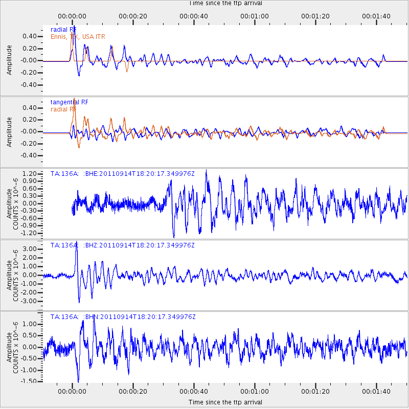
Earthquake location: Near Islands, Aleutian Islands
Earthquake latitude/longitude: 53.1/173.0
Earthquake time(UTC): 2011/09/14 (257) 18:10:09 GMT
Earthquake Depth: 15 km
Earthquake Magnitude: 6.1 MB, 5.7 MS, 6.0 MW, 6.0 MW
Earthquake Catalog/Contributor: WHDF/NEIC
Network: TA USArray Transportable Network (new EarthScope stations)
Station: 136A Ennis, TX, USA
Lat/Lon: 32.47 N/96.53 W
Elevation: 113 m
Distance: 65.0 deg
Az: 68.797 deg
Baz: 318.318 deg
Ray Param: 0.058522996
Estimated Moho Depth: 41.25 km
Estimated Crust Vp/Vs: 1.60
Assumed Crust Vp: 6.38 km/s
Estimated Crust Vs: 3.982 km/s
Estimated Crust Poisson's Ratio: 0.18
Radial Match: 84.00233 %
Radial Bump: 400
Transverse Match: 71.15264 %
Transverse Bump: 400
SOD ConfigId: 414626
Insert Time: 2012-01-23 10:39:38.476 +0000
GWidth: 2.5
Max Bumps: 400
Tol: 0.001

Signal To Noise

ChannelStoNSTALTA
TA:136A: :BHZ:20110914T18:20:17.349976Z10.0567721.5336808E-61.525023E-7
TA:136A: :BHN:20110914T18:20:17.349976Z2.7293916.3189117E-72.3151361E-7
TA:136A: :BHE:20110914T18:20:17.349976Z3.24782855.6455997E-71.738269E-7
Arrivals
Ps4.1 SECOND
PpPs16 SECOND
PsPs/PpSs20 SECOND