O34A Beatrice, NE, USA - Earthquake Result Viewer
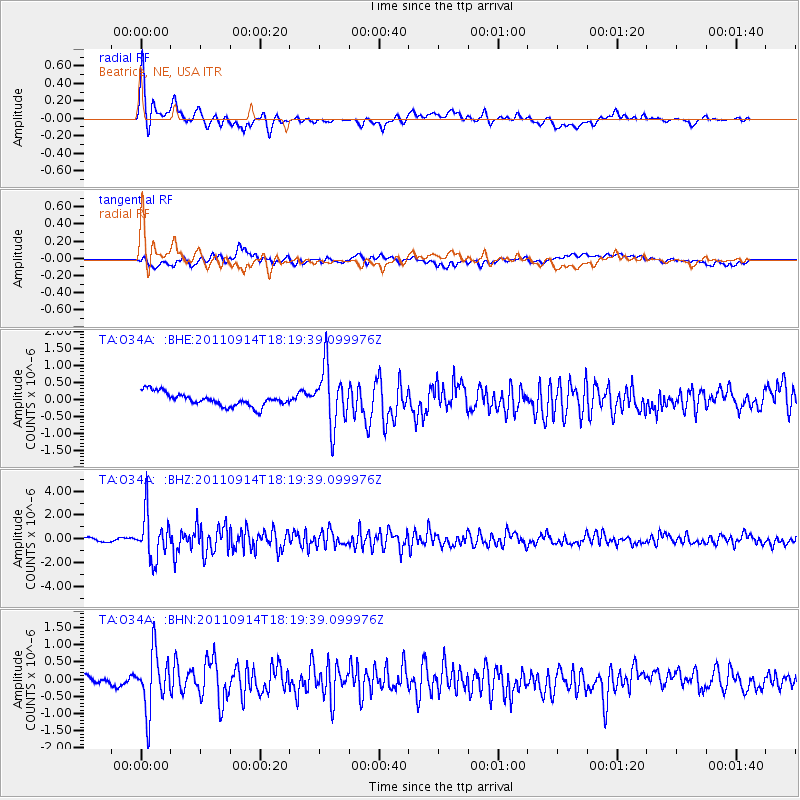
Earthquake location: Near Islands, Aleutian Islands
Earthquake latitude/longitude: 53.1/173.0
Earthquake time(UTC): 2011/09/14 (257) 18:10:09 GMT
Earthquake Depth: 15 km
Earthquake Magnitude: 6.1 MB, 5.7 MS, 6.0 MW, 6.0 MW
Earthquake Catalog/Contributor: WHDF/NEIC
Network: TA USArray Transportable Network (new EarthScope stations)
Station: O34A Beatrice, NE, USA
Lat/Lon: 40.18 N/96.69 W
Elevation: 409 m
Distance: 59.3 deg
Az: 62.966 deg
Baz: 315.495 deg
Ray Param: 0.062251206
Estimated Moho Depth: 12.5 km
Estimated Crust Vp/Vs: 2.05
Assumed Crust Vp: 6.498 km/s
Estimated Crust Vs: 3.173 km/s
Estimated Crust Poisson's Ratio: 0.34
Radial Match: 86.66005 %
Radial Bump: 400
Transverse Match: 64.063896 %
Transverse Bump: 400
SOD ConfigId: 414626
Insert Time: 2012-01-23 10:40:16.817 +0000
GWidth: 2.5
Max Bumps: 400
Tol: 0.001

Signal To Noise

ChannelStoNSTALTA
TA:O34A: :BHZ:20110914T18:19:39.099976Z17.8265061.8963871E-61.0638019E-7
TA:O34A: :BHN:20110914T18:19:39.099976Z7.9453928.3845396E-71.0552707E-7
TA:O34A: :BHE:20110914T18:19:39.099976Z4.2995398.501499E-71.9773049E-7
Arrivals
Ps2.1 SECOND
PpPs5.6 SECOND
PsPs/PpSs7.7 SECOND