M35A Neola, IA, USA - Earthquake Result Viewer
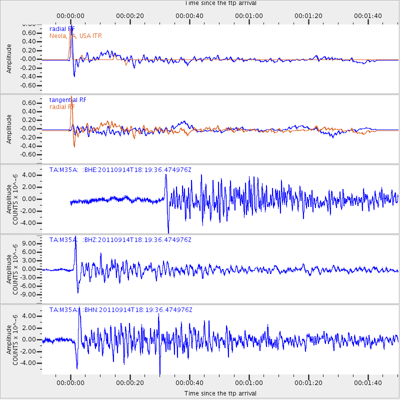
Earthquake location: Near Islands, Aleutian Islands
Earthquake latitude/longitude: 53.1/173.0
Earthquake time(UTC): 2011/09/14 (257) 18:10:09 GMT
Earthquake Depth: 15 km
Earthquake Magnitude: 6.1 MB, 5.7 MS, 6.0 MW, 6.0 MW
Earthquake Catalog/Contributor: WHDF/NEIC
Network: TA USArray Transportable Network (new EarthScope stations)
Station: M35A Neola, IA, USA
Lat/Lon: 41.47 N/95.69 W
Elevation: 363 m
Distance: 58.9 deg
Az: 61.288 deg
Baz: 315.285 deg
Ray Param: 0.062502235
Estimated Moho Depth: 35.75 km
Estimated Crust Vp/Vs: 2.01
Assumed Crust Vp: 6.498 km/s
Estimated Crust Vs: 3.241 km/s
Estimated Crust Poisson's Ratio: 0.33
Radial Match: 92.21115 %
Radial Bump: 400
Transverse Match: 77.755424 %
Transverse Bump: 400
SOD ConfigId: 414626
Insert Time: 2012-01-23 10:40:30.415 +0000
GWidth: 2.5
Max Bumps: 400
Tol: 0.001

Signal To Noise

ChannelStoNSTALTA
TA:M35A: :BHZ:20110914T18:19:36.474976Z37.208093.952203E-61.0621891E-7
TA:M35A: :BHN:20110914T18:19:36.474976Z11.9113912.200819E-61.8476591E-7
TA:M35A: :BHE:20110914T18:19:36.474976Z7.2620841.8896238E-62.6020408E-7
Arrivals
Ps5.8 SECOND
PpPs16 SECOND
PsPs/PpSs22 SECOND