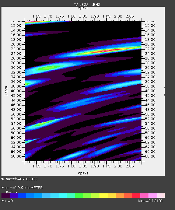
L32A Elgin, NE, USA - Earthquake Result Viewer

Earthquake location: Near Islands, Aleutian Islands
Earthquake latitude/longitude: 53.1/173.0
Earthquake time(UTC): 2011/09/14 (257) 18:10:09 GMT
Earthquake Depth: 15 km
Earthquake Magnitude: 6.1 MB, 5.7 MS, 6.0 MW, 6.0 MW
Earthquake Catalog/Contributor: WHDF/NEIC
Network: TA USArray Transportable Network (new EarthScope stations)
Station: L32A Elgin, NE, USA
Lat/Lon: 42.00 N/98.01 W
Elevation: 586 m
Distance: 57.3 deg
Az: 62.275 deg
Baz: 314.271 deg
Ray Param: 0.063543215
Estimated Moho Depth: 10.0 km
Estimated Crust Vp/Vs: 1.60
Assumed Crust Vp: 6.53 km/s
Estimated Crust Vs: 4.082 km/s
Estimated Crust Poisson's Ratio: 0.18
Radial Match: 87.03333 %
Radial Bump: 400
Transverse Match: 76.62187 %
Transverse Bump: 400
SOD ConfigId: 414626
Insert Time: 2012-01-23 10:41:28.944 +0000
GWidth: 2.5
Max Bumps: 400
Tol: 0.001

Signal To Noise

ChannelStoNSTALTA
TA:L32A: :BHZ:20110914T18:19:25.250Z18.2315312.482126E-61.3614469E-7
TA:L32A: :BHN:20110914T18:19:25.250Z7.71420572.2022195E-62.8547586E-7
TA:L32A: :BHE:20110914T18:19:25.250Z4.95812231.6111743E-63.2495657E-7
Arrivals
Ps1.0 SECOND
PpPs3.8 SECOND
PsPs/PpSs4.7 SECOND