K33A Hardington, NE, USA - Earthquake Result Viewer
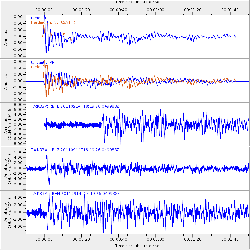
Earthquake location: Near Islands, Aleutian Islands
Earthquake latitude/longitude: 53.1/173.0
Earthquake time(UTC): 2011/09/14 (257) 18:10:09 GMT
Earthquake Depth: 15 km
Earthquake Magnitude: 6.1 MB, 5.7 MS, 6.0 MW, 6.0 MW
Earthquake Catalog/Contributor: WHDF/NEIC
Network: TA USArray Transportable Network (new EarthScope stations)
Station: K33A Hardington, NE, USA
Lat/Lon: 42.61 N/97.00 W
Elevation: 507 m
Distance: 57.5 deg
Az: 61.146 deg
Baz: 314.338 deg
Ray Param: 0.06346985
Estimated Moho Depth: 20.5 km
Estimated Crust Vp/Vs: 1.61
Assumed Crust Vp: 6.498 km/s
Estimated Crust Vs: 4.042 km/s
Estimated Crust Poisson's Ratio: 0.18
Radial Match: 85.83071 %
Radial Bump: 400
Transverse Match: 78.526886 %
Transverse Bump: 400
SOD ConfigId: 414626
Insert Time: 2012-01-23 10:41:42.084 +0000
GWidth: 2.5
Max Bumps: 400
Tol: 0.001

Signal To Noise

ChannelStoNSTALTA
TA:K33A: :BHZ:20110914T18:19:26.049988Z7.27604682.7777103E-63.817609E-7
TA:K33A: :BHN:20110914T18:19:26.049988Z3.4387822.0628916E-65.998902E-7
TA:K33A: :BHE:20110914T18:19:26.049988Z3.99124932.6828207E-66.7217564E-7
Arrivals
Ps2.0 SECOND
PpPs7.8 SECOND
PsPs/PpSs9.8 SECOND