F05D White Salmon, WA, USA - Earthquake Result Viewer
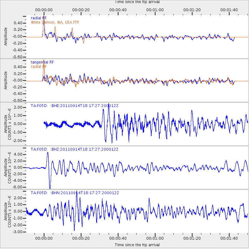
Earthquake location: Near Islands, Aleutian Islands
Earthquake latitude/longitude: 53.1/173.0
Earthquake time(UTC): 2011/09/14 (257) 18:10:09 GMT
Earthquake Depth: 15 km
Earthquake Magnitude: 6.1 MB, 5.7 MS, 6.0 MW, 6.0 MW
Earthquake Catalog/Contributor: WHDF/NEIC
Network: TA USArray Transportable Network (new EarthScope stations)
Station: F05D White Salmon, WA, USA
Lat/Lon: 45.89 N/121.46 W
Elevation: 472 m
Distance: 41.8 deg
Az: 72.472 deg
Baz: 304.608 deg
Ray Param: 0.07353284
Estimated Moho Depth: 40.5 km
Estimated Crust Vp/Vs: 1.60
Assumed Crust Vp: 6.597 km/s
Estimated Crust Vs: 4.123 km/s
Estimated Crust Poisson's Ratio: 0.18
Radial Match: 81.10579 %
Radial Bump: 400
Transverse Match: 70.196526 %
Transverse Bump: 400
SOD ConfigId: 414626
Insert Time: 2012-01-23 10:43:45.237 +0000
GWidth: 2.5
Max Bumps: 400
Tol: 0.001

Signal To Noise

ChannelStoNSTALTA
TA:F05D: :BHZ:20110914T18:17:27.200012Z14.0178172.8670124E-62.0452632E-7
TA:F05D: :BHN:20110914T18:17:27.200012Z3.20260765.963779E-71.8621635E-7
TA:F05D: :BHE:20110914T18:17:27.200012Z5.6789491.0704115E-61.8848762E-7
Arrivals
Ps4.0 SECOND
PpPs15 SECOND
PsPs/PpSs19 SECOND