
K31A O'Neill, NE, USA - Earthquake Result Viewer
| ||||||||||||||||||
| ||||||||||||||||||
| ||||||||||||||||||
|
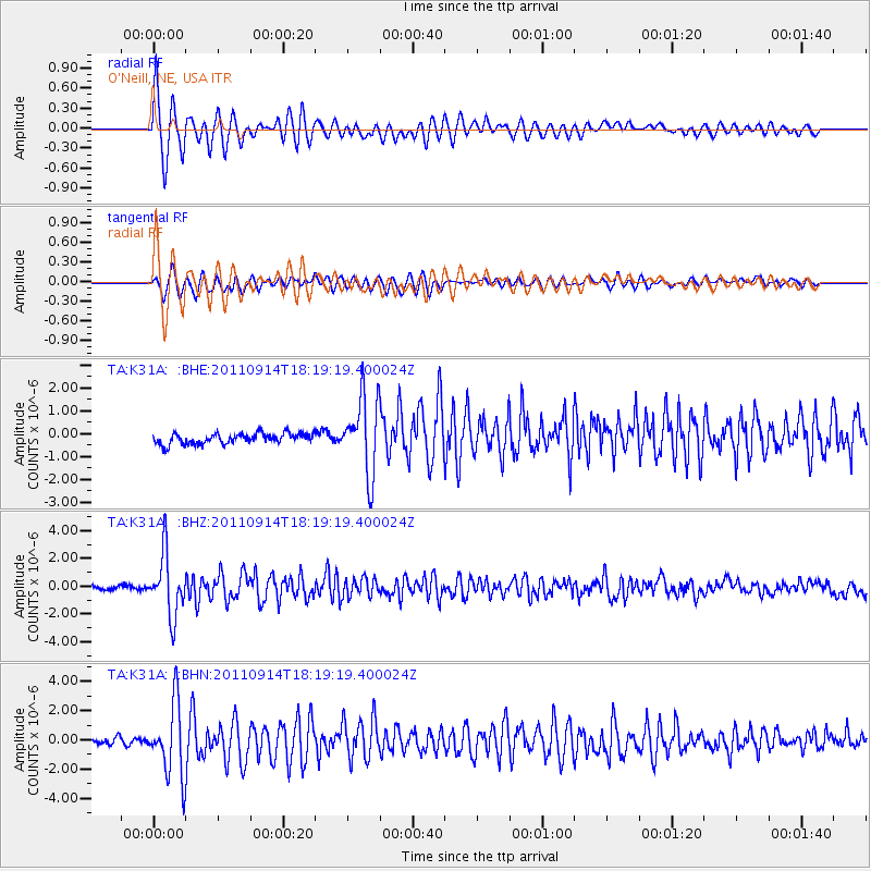
Signal To Noise
| Channel | StoN | STA | LTA |
| TA:K31A: :BHZ:20110914T18:19:19.400024Z | 19.126059 | 2.1940525E-6 | 1.1471535E-7 |
| TA:K31A: :BHN:20110914T18:19:19.400024Z | 12.0722685 | 2.4676801E-6 | 2.0440898E-7 |
| TA:K31A: :BHE:20110914T18:19:19.400024Z | 7.2357106 | 1.6769322E-6 | 2.3175778E-7 |
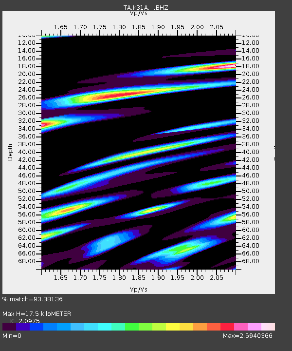
| Arrivals | |
| Ps | 3.1 SECOND |
| PpPs | 7.9 SECOND |
| PsPs/PpSs | 11 SECOND |

