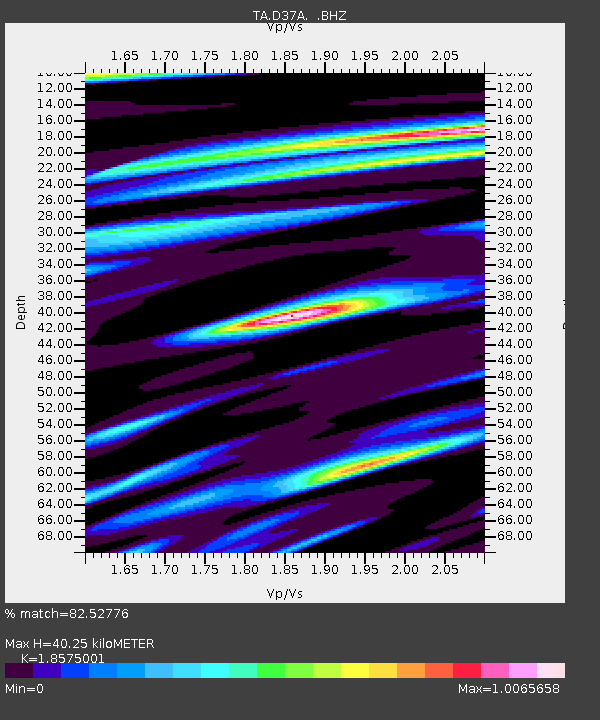
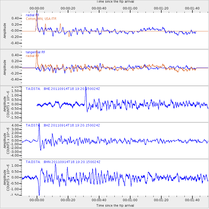
D37A Cotton, MN, USA - Earthquake Result Viewer

Earthquake location: Near Islands, Aleutian Islands
Earthquake latitude/longitude: 53.1/173.0
Earthquake time(UTC): 2011/09/14 (257) 18:10:09 GMT
Earthquake Depth: 15 km
Earthquake Magnitude: 6.1 MB, 5.7 MS, 6.0 MW, 6.0 MW
Earthquake Catalog/Contributor: WHDF/NEIC
Network: TA USArray Transportable Network (new EarthScope stations)
Station: D37A Cotton, MN, USA
Lat/Lon: 47.16 N/92.43 W
Elevation: 413 m
Distance: 56.6 deg
Az: 54.553 deg
Baz: 313.969 deg
Ray Param: 0.064013585
Estimated Moho Depth: 40.25 km
Estimated Crust Vp/Vs: 1.86
Assumed Crust Vp: 6.571 km/s
Estimated Crust Vs: 3.537 km/s
Estimated Crust Poisson's Ratio: 0.30
Radial Match: 82.52776 %
Radial Bump: 400
Transverse Match: 75.62838 %
Transverse Bump: 400
SOD ConfigId: 414626
Insert Time: 2012-01-23 10:45:36.144 +0000
GWidth: 2.5
Max Bumps: 400
Tol: 0.001

Signal To Noise

ChannelStoNSTALTA
TA:D37A: :BHZ:20110914T18:19:20.150024Z11.8158371.69721E-61.4363857E-7
TA:D37A: :BHN:20110914T18:19:20.150024Z4.1018286.0429335E-71.4732294E-7
TA:D37A: :BHE:20110914T18:19:20.150024Z4.34503846.629309E-71.5257193E-7
Arrivals
Ps5.5 SECOND
PpPs17 SECOND
PsPs/PpSs22 SECOND