G32A Webster, SD, USA - Earthquake Result Viewer
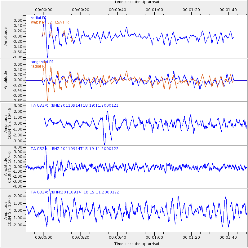
Earthquake location: Near Islands, Aleutian Islands
Earthquake latitude/longitude: 53.1/173.0
Earthquake time(UTC): 2011/09/14 (257) 18:10:09 GMT
Earthquake Depth: 15 km
Earthquake Magnitude: 6.1 MB, 5.7 MS, 6.0 MW, 6.0 MW
Earthquake Catalog/Contributor: WHDF/NEIC
Network: TA USArray Transportable Network (new EarthScope stations)
Station: G32A Webster, SD, USA
Lat/Lon: 45.26 N/97.50 W
Elevation: 566 m
Distance: 55.4 deg
Az: 59.141 deg
Baz: 312.884 deg
Ray Param: 0.064829186
Estimated Moho Depth: 55.5 km
Estimated Crust Vp/Vs: 1.88
Assumed Crust Vp: 6.552 km/s
Estimated Crust Vs: 3.495 km/s
Estimated Crust Poisson's Ratio: 0.30
Radial Match: 84.25002 %
Radial Bump: 400
Transverse Match: 62.171223 %
Transverse Bump: 400
SOD ConfigId: 414626
Insert Time: 2012-01-23 10:45:49.213 +0000
GWidth: 2.5
Max Bumps: 400
Tol: 0.001

Signal To Noise

ChannelStoNSTALTA
TA:G32A: :BHZ:20110914T18:19:11.200012Z8.6021861.6123109E-61.8743036E-7
TA:G32A: :BHN:20110914T18:19:11.200012Z3.6809721.4428645E-63.919792E-7
TA:G32A: :BHE:20110914T18:19:11.200012Z4.060851.643816E-64.0479603E-7
Arrivals
Ps7.8 SECOND
PpPs23 SECOND
PsPs/PpSs31 SECOND