K36A Gilmore City, IA, USA - Earthquake Result Viewer
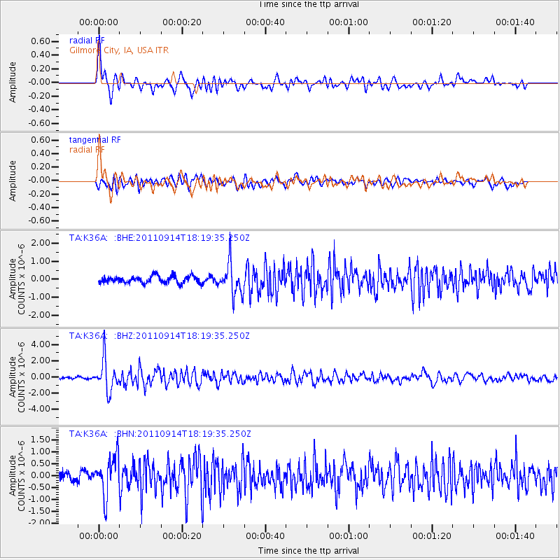
Earthquake location: Near Islands, Aleutian Islands
Earthquake latitude/longitude: 53.1/173.0
Earthquake time(UTC): 2011/09/14 (257) 18:10:09 GMT
Earthquake Depth: 15 km
Earthquake Magnitude: 6.1 MB, 5.7 MS, 6.0 MW, 6.0 MW
Earthquake Catalog/Contributor: WHDF/NEIC
Network: TA USArray Transportable Network (new EarthScope stations)
Station: K36A Gilmore City, IA, USA
Lat/Lon: 42.64 N/94.45 W
Elevation: 364 m
Distance: 58.8 deg
Az: 59.556 deg
Baz: 315.219 deg
Ray Param: 0.06261911
Estimated Moho Depth: 38.75 km
Estimated Crust Vp/Vs: 1.93
Assumed Crust Vp: 6.53 km/s
Estimated Crust Vs: 3.379 km/s
Estimated Crust Poisson's Ratio: 0.32
Radial Match: 82.0669 %
Radial Bump: 400
Transverse Match: 73.32932 %
Transverse Bump: 400
SOD ConfigId: 414626
Insert Time: 2012-01-23 10:48:20.477 +0000
GWidth: 2.5
Max Bumps: 400
Tol: 0.001

Signal To Noise

ChannelStoNSTALTA
TA:K36A: :BHZ:20110914T18:19:35.250Z14.5694731.9636632E-61.3477928E-7
TA:K36A: :BHN:20110914T18:19:35.250Z3.60410338.464871E-72.3486761E-7
TA:K36A: :BHE:20110914T18:19:35.250Z4.57356838.9902426E-71.9656954E-7
Arrivals
Ps5.8 SECOND
PpPs17 SECOND
PsPs/PpSs22 SECOND